Statewide Parcel Map Initiative
.
 .
Tools and Guides
.
Tools and Guides

Validation Tool
Check your parcel dataset for errors and prepare data geodatabases plus submission .ini form
The Validation is a dual-purpose tool that helps to:
1) Prepare a parcel dataset submission that is free of some of the most commonly found parcel
dataset errors; and
2) Offers the interface to create Parcel and Other Layers geodatabases plus the .ini submission form that must be included in the final submission package.
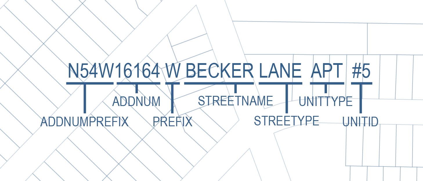
Address Parsing Tool
Parse site addresses into sub-address elements
Use this guide if your county’s parcel SITE ADDRESS data is not available as fully parsed address elements meeting the statewide parcel schema and you would like to use the given site address data to help meet the Searchable Format.
Preview Guide (.pdf) Preview Address Reference Guide (.pdf) Video (via YouTube) Download Tool (.zip) View the changelog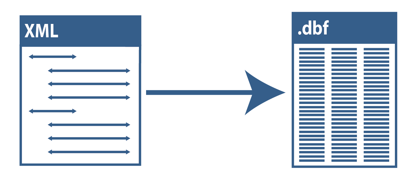
DOR XML Parse Tool
Translate Wisconsin Department of Revenue Tax Roll XML into a GIS table
Use this guide if your county’s tax roll data is already in XML format and you would like to use that
XML data to help meet Searchable Format.
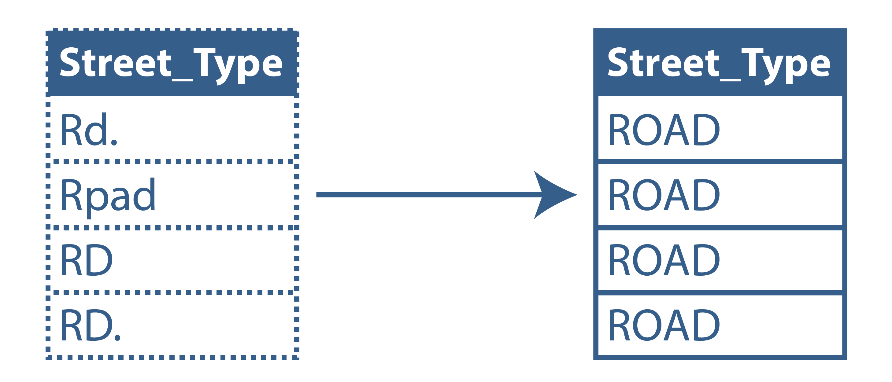
Data Standardize Tool
Standardize file geodatabase feature class data via the creation of a lookup table.
This toolbox contains a two-tool sequence. The first tool may be used to create a summary table of a field. This table will then be edited by the user and subsequently used as input to the secondary tool. The output of the second tool will include all original field domains as well as newly standardized domains in a new field as defined by the user in the lookup table. The output will be written to a new feature class.
Preview Guide (.pdf) Video (via YouTube) Download Tool (.zip) View the changelog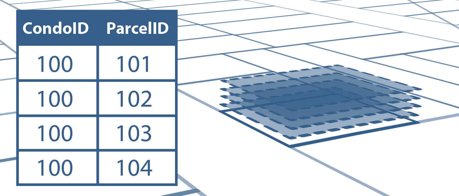
Condo Stack Tool
Model condos by stacking condo parcel geometries by owner.
Use this tool to model condo parcel geometries to match tax roll records with a 1:1 relationship.
Preview Guide (.pdf) Download Tool (.zip) View the changelog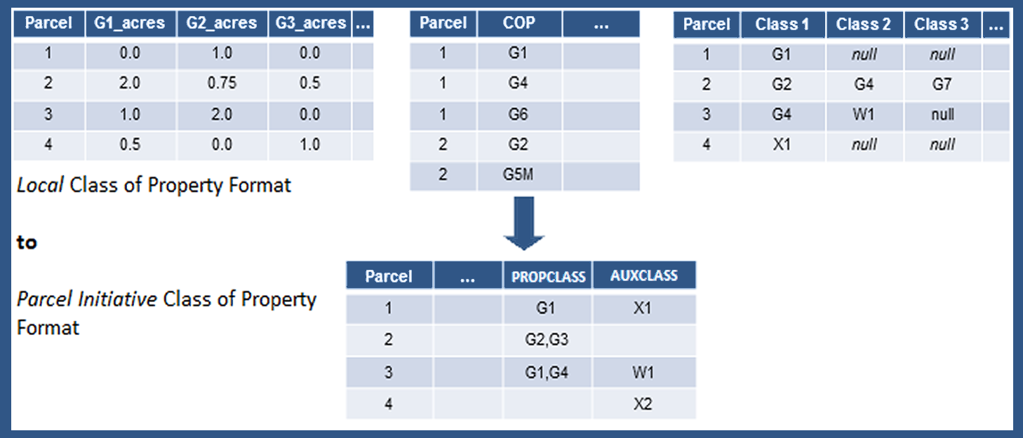
Class of Property Dissolve Toolset
Format class of property data to the Parcel Initiative's schema definitions.
This tool may be helpful if you wish to reformat your class of property information so as to meet the requirements of the statewide parcel schema definitions of PROPCLASS and AUXCLASS. This tool will handle various common formats for class of property and may be helpful if your data exists in one of these formats.
Preview Guide (.pdf) Download Tool (.zip) View the changelog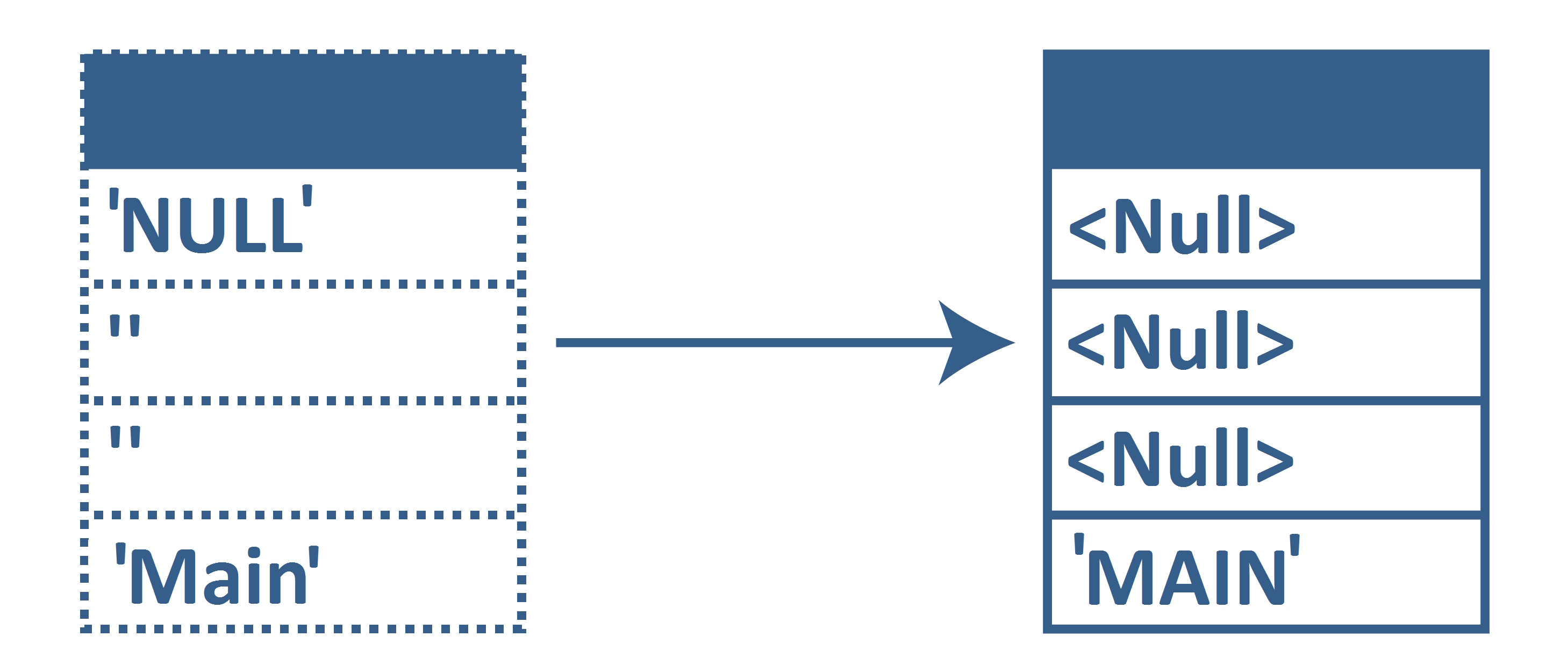
Null Fields and Set to UPPERCASE Tool
Format all attributes within a feature class to <Null> and UPPERCASE.
This tool may be helpful if you wish to format your blank fields or fields annotated with a specific string to a true SQL Null> or if you wish to set all fields to UPPERCASE alpha characters.
Download Tool (.zip) View the changelog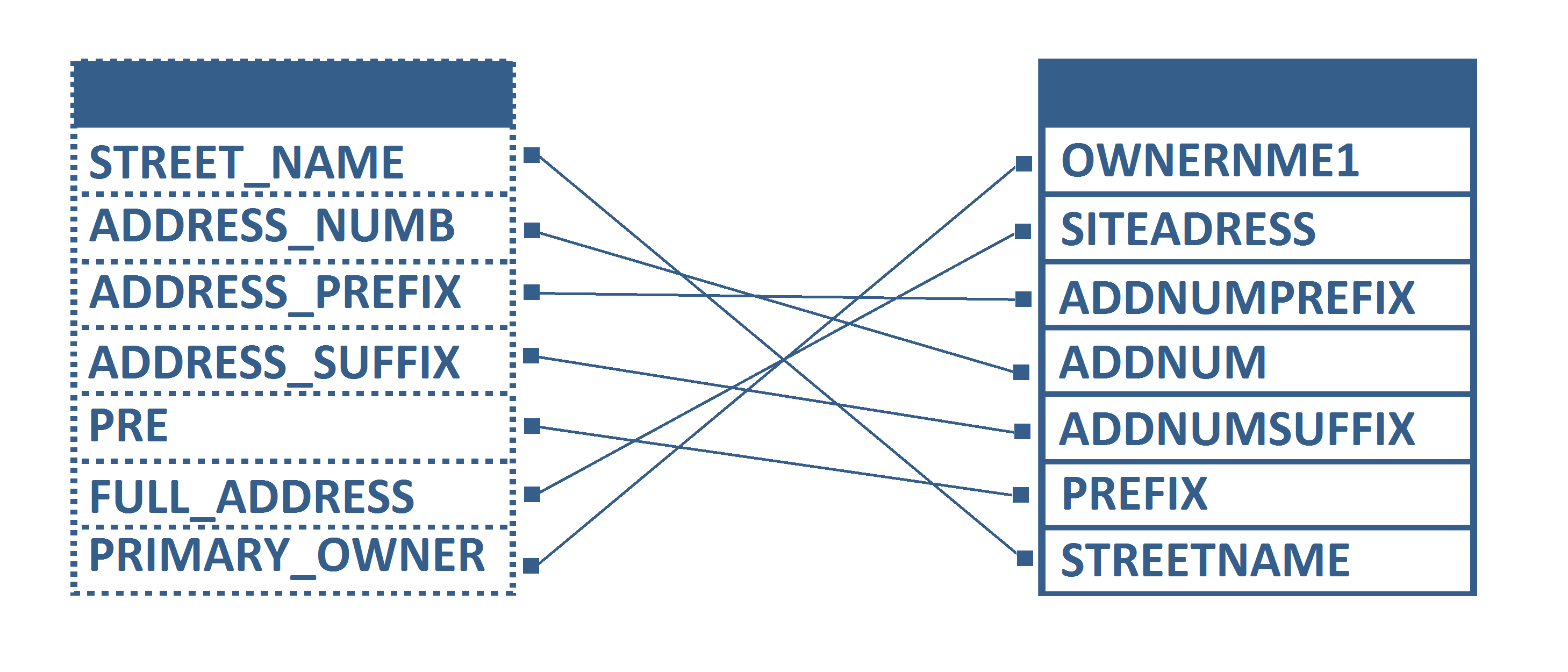
Field Mapping Workflow Documentation
Use this guide for mapping your parcel attributes to the Statewide Parcel Schema.
This guide may be useful if you have PARCEL data formatted to the statewide schema specifications but the fields do not have one or more of the following qualities:
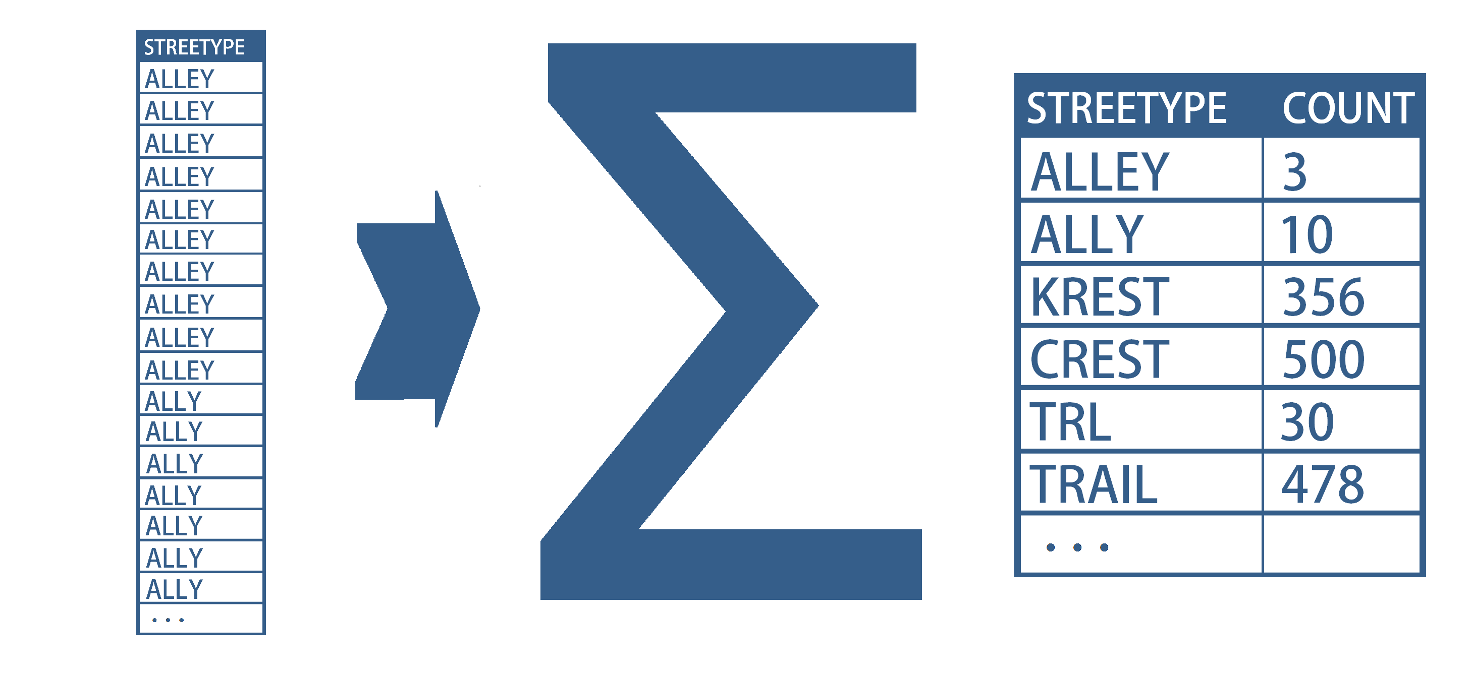
Summary Table Guide
Use this guide if you wish to examine your submission in preparation for submitting your searchable format data. This guide is of particular use for cleaning, validating, and standardizing data.
Creating and using summary tables can be an efficient and effective means for understanding, assessing, and standardizing your data. Through the simple workflows outlined in this guide, you’ll be able to know exactly what domains exist within a field and quickly be able to apply corrections to the data, if needed.
Preview Guide (.pdf)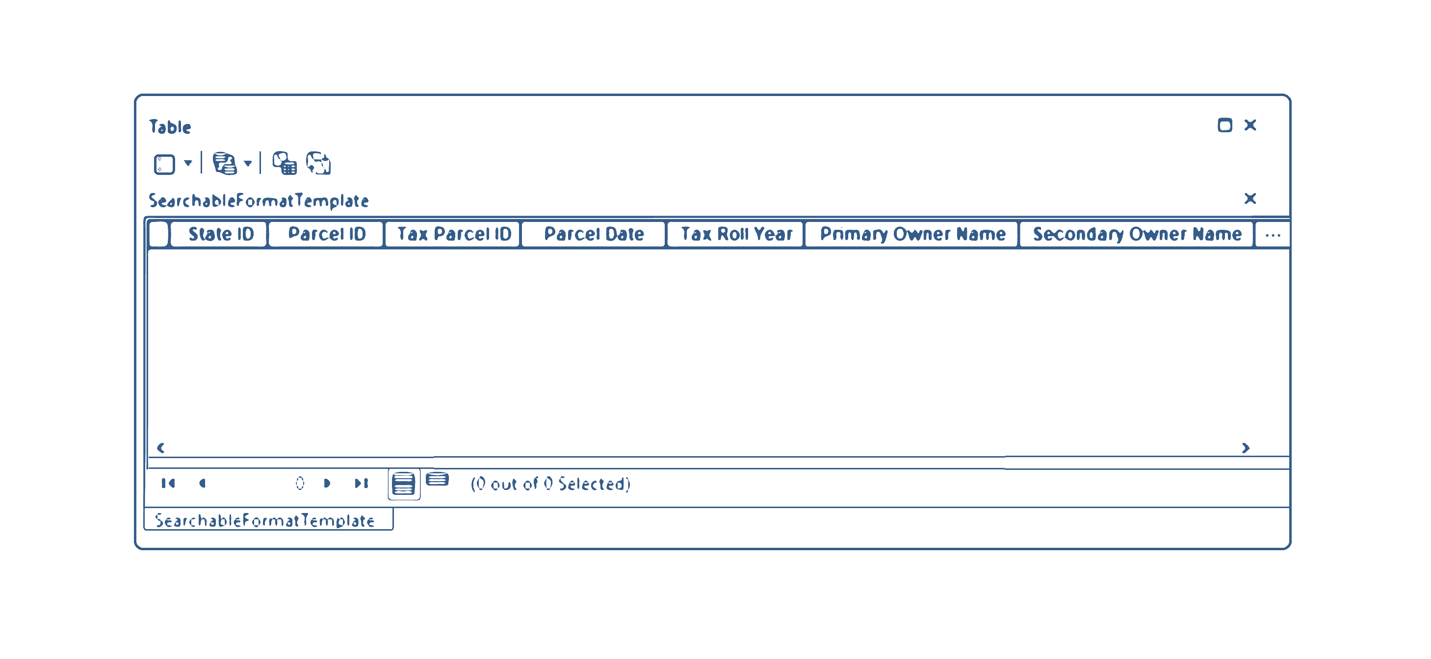
GIS Template - Searchable Format
Contains the attribute schema and coordinate reference system as specified for achieving the Searchable Format.
The template contains no features so that you can readily load your parcel features and field map as appropriate using the Field Mapping Workflow Documentation.