
Quick Links
- WHAIFinder – View and download free Wisconsin aerial photography. WHAIFinder contains downloadable photos for roughly every decade, 1936 to present. For additional photography available from other sources, visit our Aerial Photography Catalog.
- WI Aerial Photography Catalog – Search for aerial photography (1930’s to present)
- GeoData@Wisconsin Aerial Imagery Downloads – Designed for more technically-inclined people
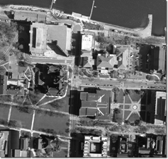
An aerial photograph is a picture of the Earth’s surface taken with a specialized camera mounted in an airplane. Millions of dollars are spent each year by local, regional, state, tribal, and federal government agencies, as well as private companies, to collect aerial photography over the United States.
Current Wisconsin Aerial Photography
As a general rule, local government agencies in Wisconsin acquire new aerial photography every 3-5 years. More urbanized counties and quickly-developing municipalities may acquire new aerial photography as often as every 2-3 years.
A statewide flight was conducted by the U.S. Department of Agriculture during the summer of 2024. This was in addition to a large number of counties that acquired new aerial photography in the springs of 2023-2025.
Options
- First, some background: people in the mapping industry commonly refer to the “resolution” of an aerial photograph. For example, a 3-inch resolution aerial photograph means each pixel in the image represents three inches on the ground. All aerial photography today is collected digitally, meaning the end product is a digital photograph that can be used and manipulated on a computer.
- Aerial photography from the 2024 summer project (called the National Agriculture Imagery Program or “NAIP”) is not yet available due to delays at the federal level. However, statewide NAIP photos from 2022 are available in WHAIFinder. NAIP has a relatively low resolution of 0.6 meters, which means individual houses will become very blurry if you zoom in on the image.
- High resolution digital aerial photographs acquired by county governments in 2023-2025 are available directly from counties. Visit the “GIS Webmapping Applications Link” shown in this list of county contacts, or contact the Land Information Officer (LIO) for more information.
- You may also download free but older higher-resolution photographs from spring 2018-2020 county flights via GeoData@Wisconsin.
Historic Aerial Photography
Federal agencies began acquiring widespread aerial photography over Wisconsin in the 1930’s. Over time, counties, regional, and municipal government agencies also began contracting with private service providers to acquire even higher resolution photography. While film cameras were common for nearly 75 years, today all aerial photography is acquired digitally with very expensive, specialized cameras.
Our Wisconsin Historic Aerial Image Finder (“WHAIFinder”) is a great way to find and download free historic aerial photography from the 1930s to the present. Working in partnership with the Arthur H. Robinson Map Library, we aim to make at least one photo available per decade for every location in Wisconsin.
While WHAIFinder is comprehensive, additional photography will be available from other sources in print format. If you can’t find what you need in WHAIFinder, visit our Wisconsin Aerial Photography Catalog for additional options.