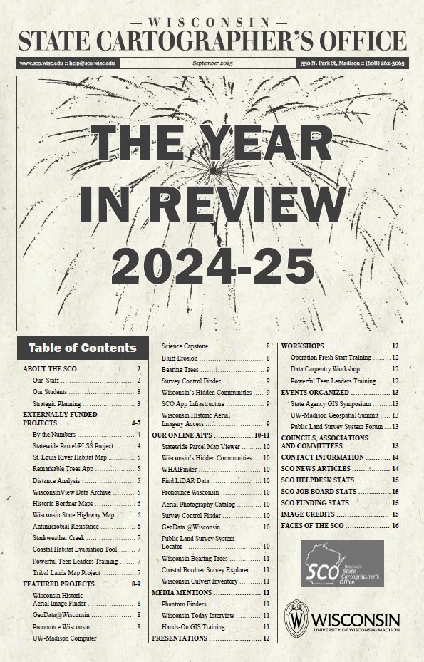
| State Cartographer’s Office Annual Report, 2024-25 | Read about our activities in 2024-25. | 09/30/2025 |
| State Cartographer’s Office Annual Report 2023-24 | Everything you want to know about the SCO’s activities in 2023-24. | 10/17/2024 |
| SCO Strategic Framework 2024 | This 2024 Strategic Framework was developed by the staff of the State Cartographer’s Office from 2023-24. It is used as a guide to help ensure that activities of the office align to identified strategic priorities. | 08/23/2024 |
| State Cartographer’s Office Annual Report, 2022-23 | Our annual report, detailing activities of the State Cartographer’s Office over the previous year. | 09/22/2023 |
| State Cartographer’s Annual Report, 2021-22 | Report on State Cartographer’s Office activities from July 1, 2021 through June 30, 2022. | 09/20/2022 |
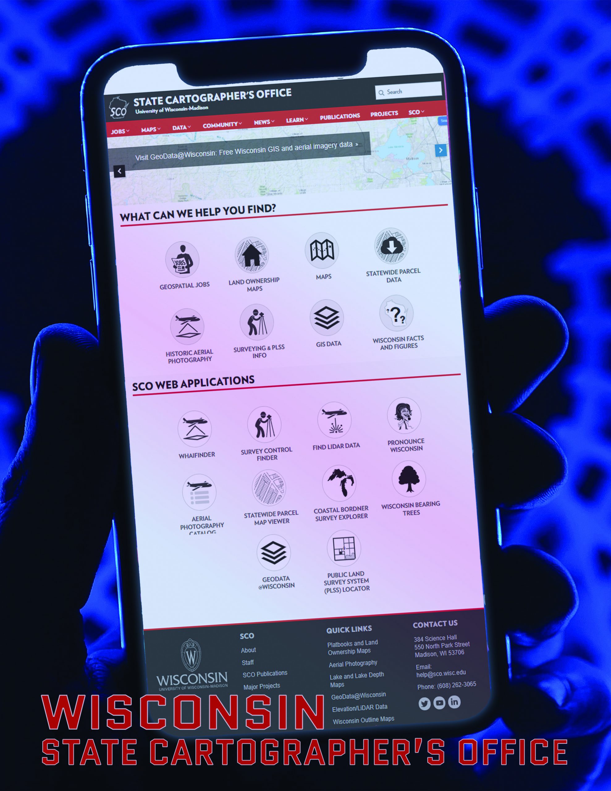
| State Cartographer’s Office Brochure | A brochure highlighting the online apps of the State Cartographer’s Office. | 03/02/2022 |
| State Cartographer’s Office Annual Report, 2020-21 | Report on State Cartographer’s Office activities from July 1, 2020 through June 30, 2021. | 08/12/2021 |
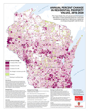
| Map of Annual Change in Residential Property Values, 2016-2020 | This poster-sized map (24×30 in.) shows the annual percent increase or decrease in total assessed value for improved residential properties in Wisconsin, using data from Versions 3 and 7 of the Statewide Parcel Database. | 07/13/2021 |
| State Cartographer’s Office Annual Report, Fiscal Year 2020 | Report of State Cartographer’s Office activities from July 2019 through June 2020. | 08/13/2020 |
| State Cartographer’s Office Annual Report – Fiscal Year 2019 | Summary of the activities of the State Cartographer’s Office from July 1, 2018 to June 30, 2019 (Fiscal Year 2019). | 08/29/2019 |
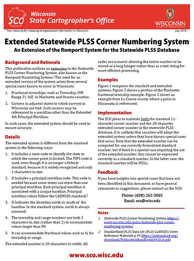
| Extended Statewide PLSS Corner Numbering System | This publication outlines an extension to the Statewide PLSS Corner Numbering System, also known as the Romportl Numbering System. The need for an extended version of the system arises from several special cases known to … | 07/24/2019 |
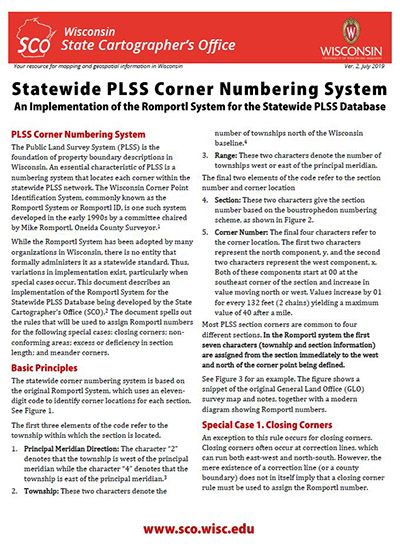
| Statewide PLSS Corner Numbering System | The Public Land Survey System (PLSS) is the foundation of property boundary descriptions in Wisconsin. An essential characteristic of PLSS is a numbering system that locates each corner within the statewide PLSS network. The Wisconsin … | 07/24/2019 |
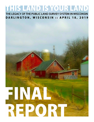
| Final Report, This Land Is Your Land | Report for the one-day forum entitled This Land Is Your Land held at the Lafayette County Multipurpose Building in Darlington on April 18, 2019 — the fifth annual PLSS forum organized by the PLSS Work … | 05/14/2019 |
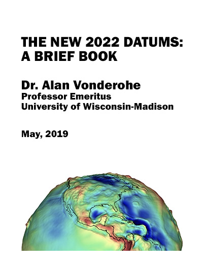
| The New 2022 Datums: A Brief Book | In 2022, the National Geodetic Survey will adopt and publish two new geodetic datums that are the underlying bases for positioning, mapping, and navigation. The new datums will impact many human activities. They will have … | 05/13/2019 |
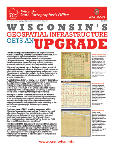
| Wisconsin’s Geospatial Infrastructure Gets an Upgrade | Overview of a project to integrate PLSS (Public Land Survey System) data into the statewide parcel database. | 01/03/2019 |
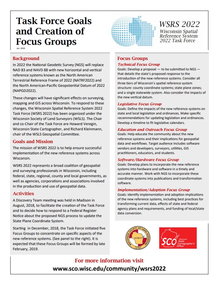
| WSRS 2022 Task Force Goals and Creation of Focus Groups | Describes the goals, mission, current activities and focus groups of WSRS 2022, the Wisconsin Spatial Reference System 2022 Task Force. | 01/03/2019 |
| State Cartographer’s Office Annual Report – Fiscal Year 2018 | Summary of the activities of the State Cartographer’s Office from July 1, 2017 to June 30, 2018 (Fiscal Year 2018). | 08/13/2018 |
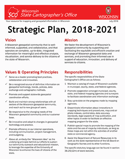
| SCO Strategic Plan (2018-2021) | SCO strategic plan for the period of July 1, 2018 through June 30, 2021. | 07/24/2018 |
| Final Report, 2018 Surveying-Parcel Forum | Report on a public forum entitled, “Meet Me at the Corner,” held on April 25, 2018. | 05/16/2018 |
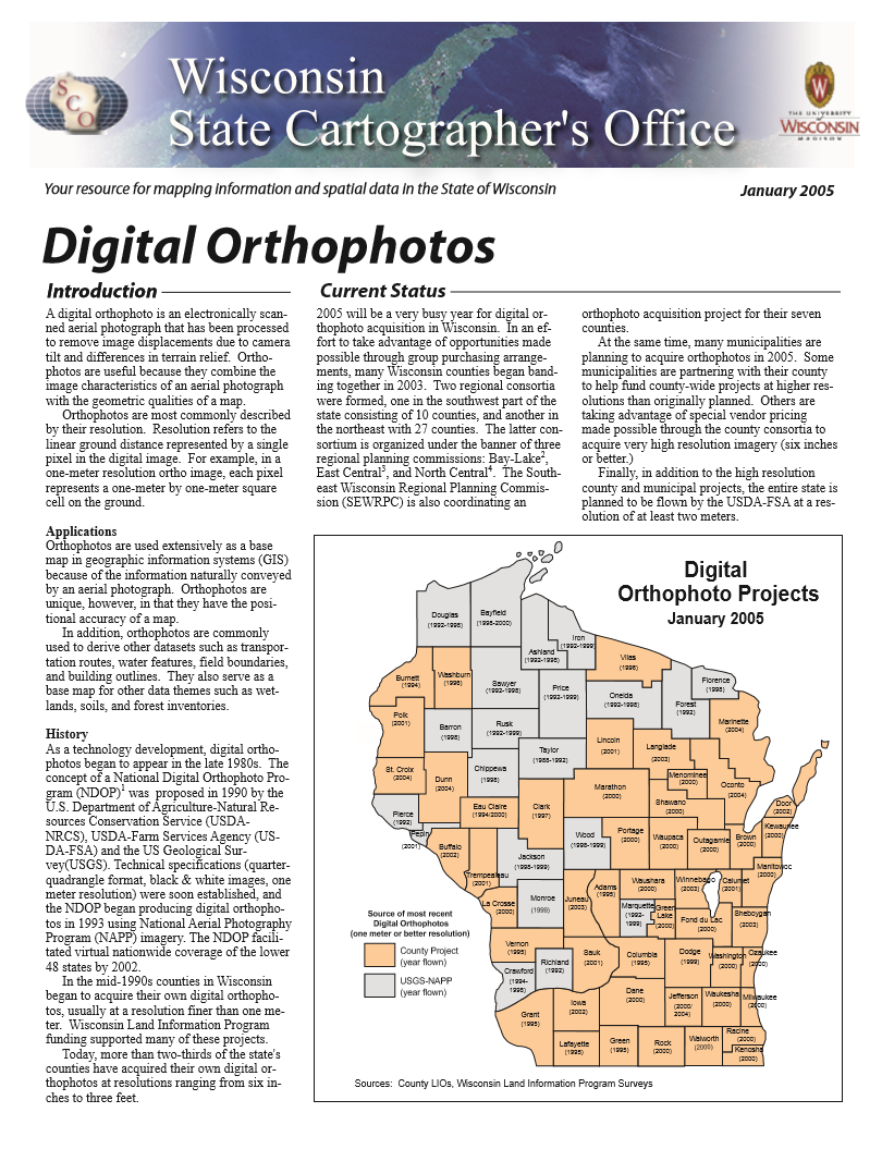
| Wisconsin Orthophotography (2005) | This SCO infosheet discusses the current status of aerial imagery in the state of Wisconsin. | 12/31/2005 |
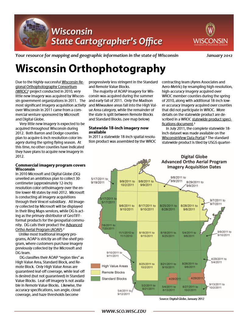
| Wisconsin Orthophotography (2012) | This SCO infosheet discusses the current status of aerial imagery in the state of Wisconsin. | 01/28/2012 |
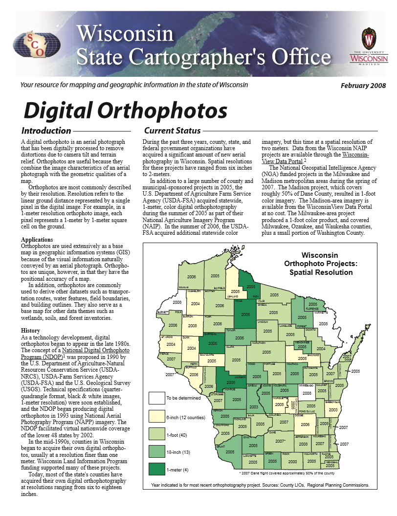
| Wisconsin Orthophotography (2008) | This SCO infosheet discusses the current status of aerial imagery in the state of Wisconsin. | 01/31/2008 |
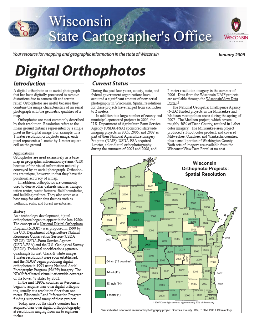
| Wisconsin Orthophotography (2009) | This SCO infosheet discusses the current status of aerial imagery in the state of Wisconsin. | 01/20/2009 |
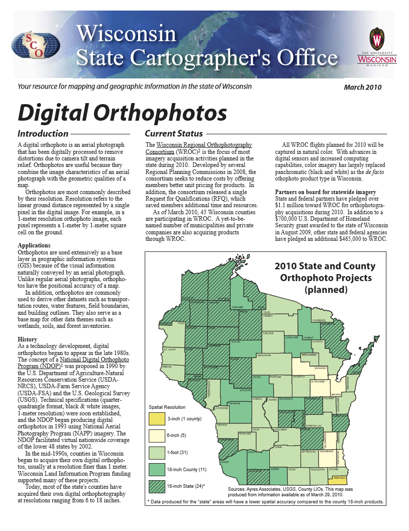
| Wisconsin Orthophotography (2010) | This SCO infosheet discusses the current status of aerial imagery in the state of Wisconsin. | 03/29/2010 |
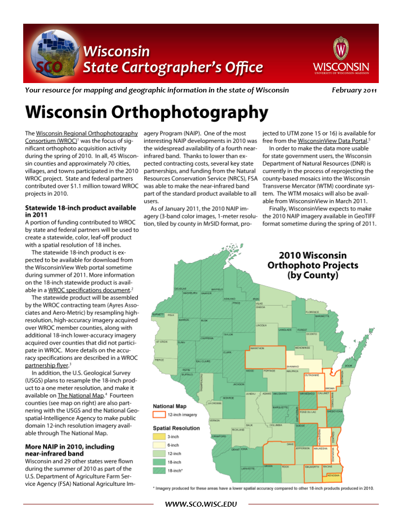
| Wisconsin Orthophotography (2011) | This SCO infosheet discusses the current status of aerial imagery in the state of Wisconsin. | 02/09/2011 |
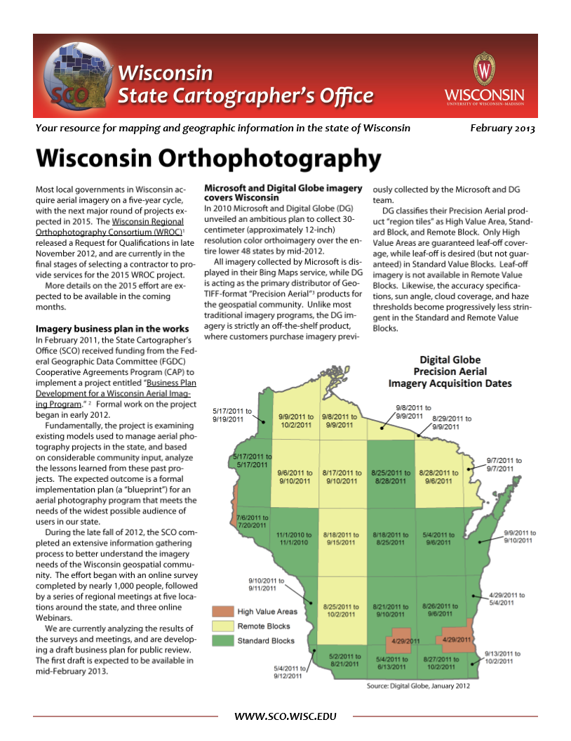
| Wisconsin Orthophotography (2013) | This SCO infosheet discusses the current status of aerial imagery in the state of Wisconsin. | 01/24/2013 |
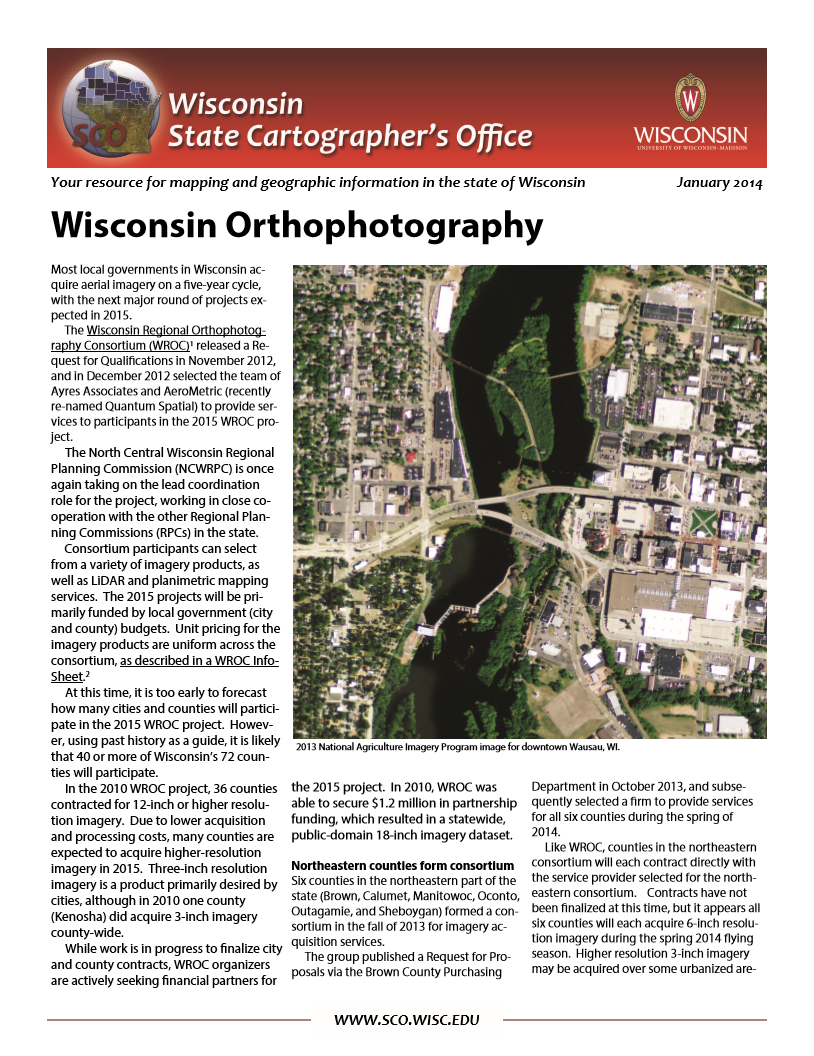
| Wisconsin Orthophotography (2014) | This SCO infosheet discusses the current status of aerial imagery in the state of Wisconsin. | 01/21/2014 |
| Wisconsin Orthophotography (2015) | This SCO infosheet discusses the current status of aerial imagery in the state of Wisconsin. | 01/20/2015 |
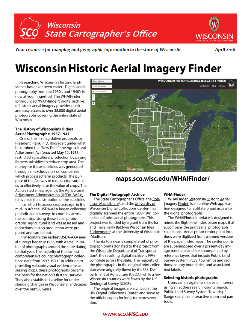
| Wisconsin Historic Aerial Imagery Finder | The WHAIFinder (pronounced “WAY-finder”) digital archive of historic aerial imagery provides quick and easy access to over 38,000 digital aerial photographs covering the entire state of Wisconsin. | 04/18/2018 |
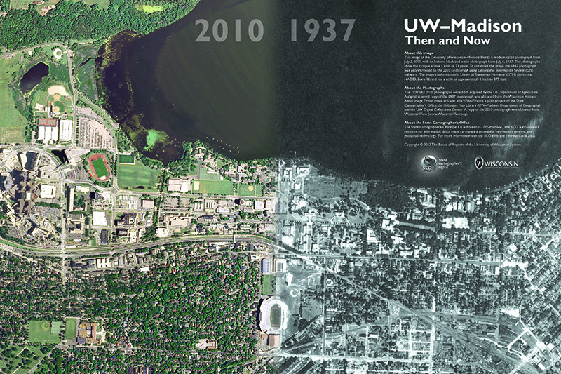
| UW-Madison “Then and Now” Poster | This image of the University of Wisconsin–Madison blends a modern color photograph from July 2, 2010, with an historic black and white photograph from July 6, 1937. The photographs show the campus across a span of 73 years. | 11/13/2012 |
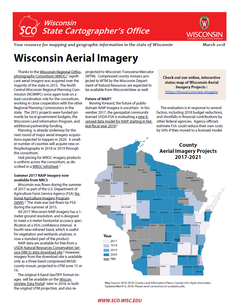
| Wisconsin Aerial Imagery (2018) | This SCO infosheet discusses the current status of aerial imagery in the state of Wisconsin. This includes both historic aerial photography, and present-day orthoimagery projects conducted by local, state, and federal government organizations. | 01/26/2018 |
| Statewide Orthophotography Planning | In 2012, the State Cartographer’s Office began work on a Federal Geographic Data Committee Cooperative Agreement Program project entitled “Business Plan Development for a Wisconsin Aerial Imaging Program.” This infosheet provides an overview of the project. | 01/18/2013 |
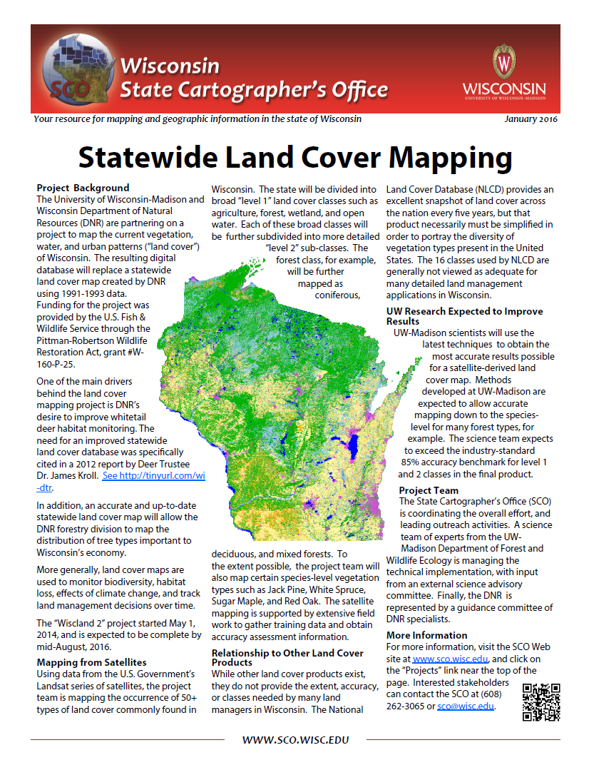
| Statewide Land Cover Mapping Project | The University of Wisconsin-Madison and Wisconsin Department of Natural Resources (DNR) partnered on a project to map the current vegetation, water, and urban patterns (“land cover”) of Wisconsin. | 01/25/2016 |
| Quick and Easy Web Maps with Google Fusion Tables | This technical paper is obsolete, since Google Fusion Tables will be shut down on Dec 3, 2019. | 02/28/2014 |
| Creating Web and Mobile Maps Using ArcGIS Online | This SCO Technical Paper provides an introduction to Esri’s ArcGIS Online Platform. ArcGIS Online is a simple cloud-based utility for producing, editing, and sharing geospatial data. Designed by Esri, the makers of the popular ArcGIS … | 02/27/2012 |
| Final Report, 2016 Surveying-Parcel Forum | Report on a public forum entitled, “Parcel Mapping and the Public Land Survey in Wisconsin,” hosted by the Wisconsin State Cartographer’s Office in 2016. | 04/27/2016 |
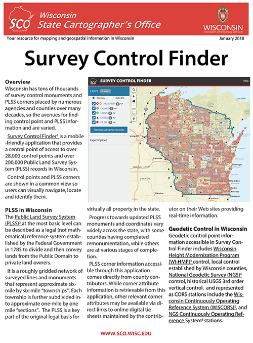
| Survey Control Finder | Survey Control Finder is a mobile-friendly web app that provides a central point of access to over 28,000 control points and over 200,000 Public Land Survey System records in Wisconsin. | 02/07/2018 |
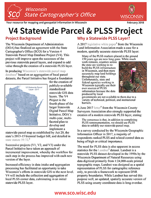
| V4 Statewide Parcel & PLSS Project | Details about Wisconsin’s statewide parcel and PLSS project. | 02/07/2018 |
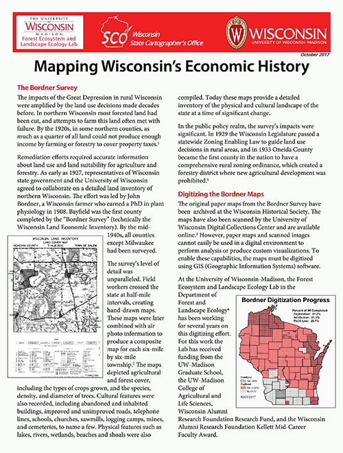
| Mapping Wisconsin’s Economic History | This publication describes a project that created a digital GIS database and portal of historic “Bordner” maps for the coastal areas of Wisconsin. | 10/10/2017 |
| State Cartographer’s Office Annual Report – Fiscal Year 2017 | Summary of the activities of the State Cartographer’s Office from July 1, 2016 to June 30, 2017 (Fiscal Year 2017). | 09/08/2017 |
| SCO Strategic Plan (2016-2017) | SCO strategic plan for the period of July 1, 2016 through June 30, 2017. | 07/01/2016 |
| SCO Strategic Plan (2013-2016) | SCO strategic plan for the period of July 1, 2013 through June 30, 2016. | 07/01/2013 |
| SCO Strategic Plan (2010-2013) | SCO strategic plan for the period of July 1, 2010 through June 30, 2013. | 08/02/2010 |
| A Concept for a State Geospatial Data Portal | The State Cartographer’s Office drafted a position paper presenting a concept for a state geospatial data portal that goes beyond immediate needs and attempts to address some of the critical issues related to user requirements for geospatial data access in Wisconsin. This paper tries to consider how the state of Wisconsin should invest in geospatial infrastructure for the future, in order to maximize the return on the investment made over the last three decades through the Land Information Program. | 12/07/2016 |
| Using geospatial PDFs | This document provides an overview of geospatial PDFs and their basic features, as well as some of the tools available to interact with these files, using USGS US Topos as a case study. 2nd edition, published in 2019. | 09/17/2019 |
| Using Web Analytics to Evaluate Online Maps | This article, published in the Journal of Web Librarianship, uses Web analytics to evaluate the effectiveness of online maps to support community outreach efforts. The specific focus is the WHAIFinder (Wisconsin Historic Aerial Image Finder), which provides online access to a rare collection of aerial photographs from the 1930s. | 02/28/2014 |
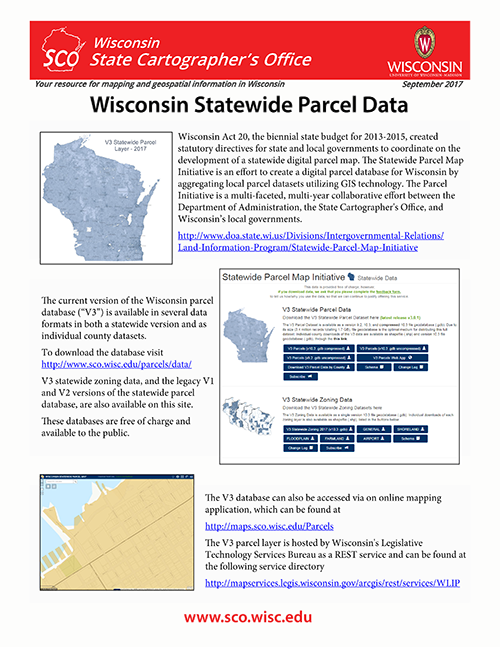
| Statewide Parcel Data | Details on accessing Wisconsin’s statewide parcel data, via ftp, web application, or REST service. | 09/25/2017 |
| Analysis of Web-Usage Statistics to Evaluate the Effectiveness of Online Maps for Community Outreach | This study employs Web-usage statistics to assess the effectiveness of the WHAIFinder (Wisconsin Historic Aerial Image Finder) application for meeting community outreach goals. | 08/07/2012 |
| An Open Source Web Application for Historic Air Photo Display and Distribution in Wisconsin | This paper describes an effort to build a digital archive and web-based retrieval system for historic air photos for the state of Wisconsin. The University of Wisconsin-Madison has an extensive collection of historic air photos, including a rare 1937-1941 collection that covers almost the entire state. | 04/22/2011 |
| Concepts and Methods for Rule-Based Web Cartography | One of the ways that interactive Web-based maps are different from traditional paper maps is that Web maps permit users to dynamically change map scale by interacting with a zoom tool. The ability to dynamically change map scale poses some challenges for cartographic design, since the mapping engine must be prepared to effectively render map data for different scale displays. This Technical Paper provides a quick overview of concepts and methods for Web-based cartography, with specific reference to issues of content selection and feature symbolization in the context of scale change. | 08/09/2011 |
| Final Report, LinkWISCONSIN Address Point and Parcel Mapping Project | Final report of the LinkWISCONSIN Address Point and Parcel Mapping Project. This project was funded by the Public Service Commission of Wisconsin with an American Recovery and Reinvestment Act grant awarded by the National Telecommunications and Information Administration. The report describes the processes used to integrate address point and parcel data from Wisconsin’s counties and municipalities to create statewide layers. | 09/29/2014 |
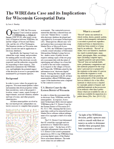
| The WIREdata case and its implications for Wisconsin geospatial data | On June 25, 2008, the Wisconsin Supreme Court issued an opinion in WIREdata Inc. v. Village of Sussex (2008 WI 69), after nearly seven years of litigation between WIREdata, Inc. and the villages of Sussex and Thiensville, and the city of Port Washington. The litigation touches on Wisconsin state public records law and its application to electronic databases. This publication summarizes the WIREdata case, and highlights the potential impact of the decision on access to geospatial data maintained by government agencies. | 01/05/2009 |
| 2009 Wisconsin GIS Inventory Report | This report provides a structured view of county-based GIS capacity in Wisconsin through an inventory of GIS data assets, technical capacity, and management practices. The report is based on self-reported statistics for 2008-2009 using the Wisconsin GIS Inventory tool with answers provided by representatives of Land Information Offices (LIOs) in each county. | 05/01/2009 |
| 2013 WLIP Report | This report — jointly published by the Wisconsin Department of Administration and the State Cartographer’s Office — discusses how Wisconsin Land Information Program (WLIP) funding is invested in county geospatial infrastructure, the 2013 county survey results, and the challenges and opportunities for the aggregation of county map data into statewide GIS layers. | 11/25/2013 |
| 2014 WLIP Report | The 2014 WLIP Report was published jointly by the Wisconsin Department of Administration and the State Cartographer’s Office. The report discusses how WLIP funding was invested in county geospatial infrastructure in 2013, and gives the results of the 2014 WLIP survey focusing on county priorities for parcel map development. | 09/24/2014 |
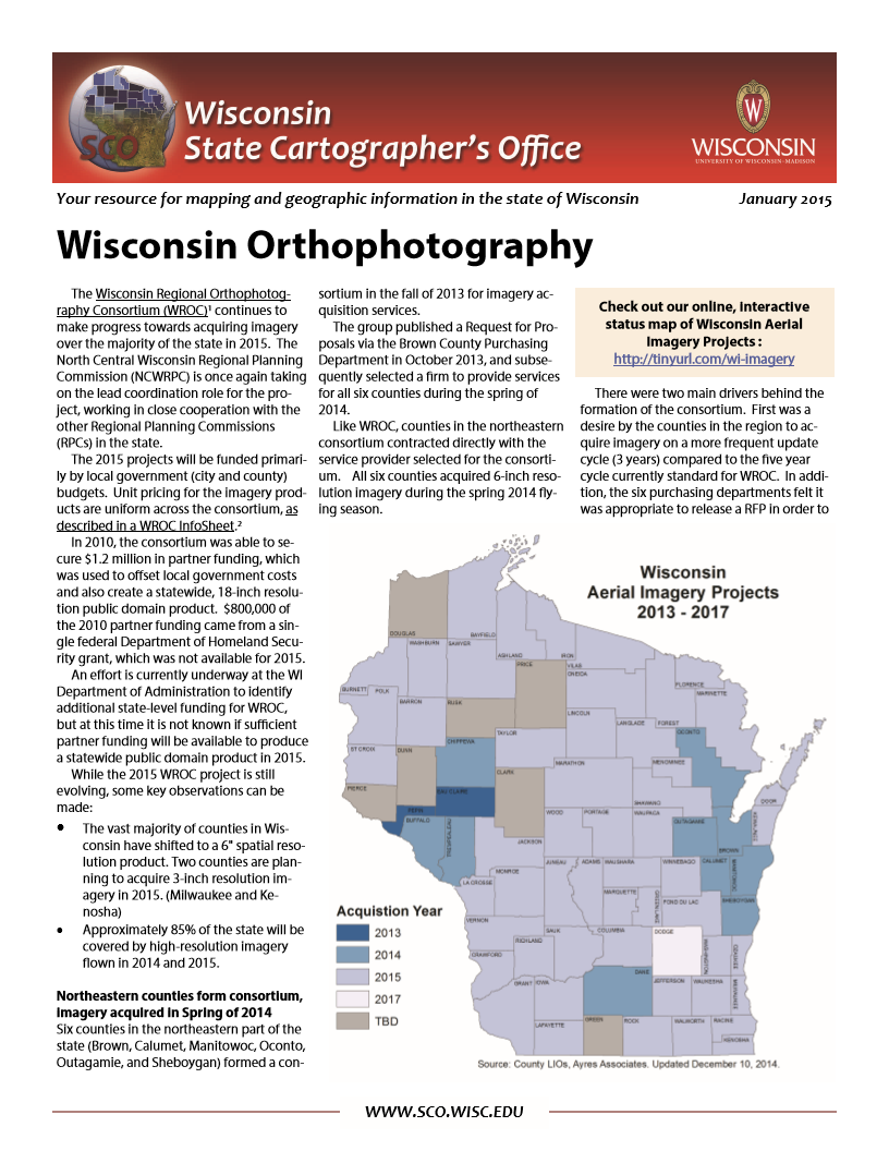
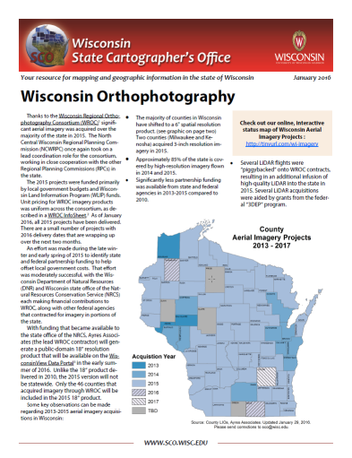
| Wisconsin Orthophotography (2016) | This Infosheet summarizes the status of orthophoto projects in Wisconsin, and describes current and future trends that affect imagery users in the state. | 01/29/2016 |
| Wisconsin Aerial Imagery: A Blueprint for Moving the State Forward | This discussion paper proposes an implementation strategy for a Wisconsin statewide aerial imagery program. The recommendations in this document were developed following an open and participatory process conducted in 2012 and 2013 where imagery stakeholders throughout Wisconsin provided their insights and requirements for a statewide aerial imagery plan. | 06/03/2014 |
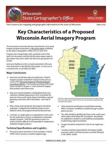
| Key Characteristics of a Proposed Wisconsin Aerial Imagery Program | This document summarizes the key components of a Wisconsin aerial imagery program proposed in a discussion paper published by the State Cartographer’s Office. This includes recommendations for contracting, technical standards, funding, and other logistics. | 06/02/2014 |
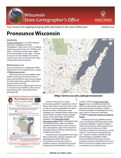
| Pronounce Wisconsin | Pronounce Wisconsin is an online application that delivers audio pronunciations for over 1700 Wisconsin places – including counties, cities, villages, and unincorporated communities – through an easy-to-use map interface. | 01/17/2014 |
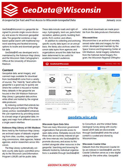
| GeoData@Wisconsin | GeoData@Wisconsin an online geoportal for fast and free access to Wisconsin geospatial data. The geoportal combines a map-based spatial search with traditional keyword searching and faceted browsing options to locate and download geospatial data. GeoData@WI was developed and is maintained by the Robinson Map Library and the Wisconsin State Cartographer’s Office at the University of Wisconsin-Madison. | 01/27/2020 |
| Final Report, 2015 Surveying-Parcel Forum | Report on a public forum entitled, “Aligning County Surveying and Parcel Mapping Efforts in Wisconsin,” hosted by the Wisconsin State Cartographer’s Office on March 12, 2015, at UW-Stevens Point. | 05/07/2015 |
| Using Maps in Web Analytics to Evaluate the Impact of Web Based Extension Programs | This article, published in the Journal of Extension, shows how maps can be used in a Web analytics context to help assess the impact of outreach and Extension programs. The article shows how maps can be generated from Web analytics data using free GIS software. | 06/30/2015 |
| Wisconsin Historic Landscape Project 2015 Community Forum Report | Report on a series of public forums held in 2015 to gather information on user needs for the Wisconsin Historic Landscape Database. This database was derived from the 1832-1866 General Land Office survey of Wisconsin documenting information about soils, vegetation, cultural features, and wetlands. | 07/11/2016 |
| Parcelization in rural agricultural and forested landscapes in Wisconsin, 1972–2007 | This study, published in the Journal of Land Use Science, examines the social, economic, geographic/biophysical, and regulatory factors underlying parcelization — the subdivision of large landholdings — in rural Wiscosnin over a period of 35 years. Results paint a unique picture of the complex interplay of historic and contemporary parcelization drivers. | 12/05/2016 |
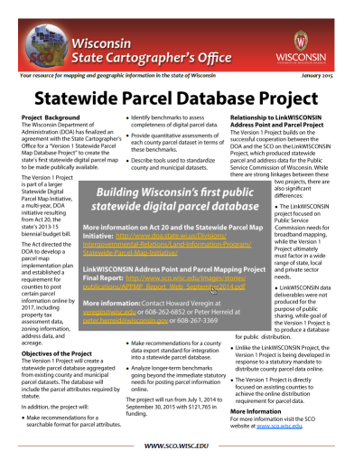
| Statewide Parcel Project | Announcement of a new collaborative project with the Wisconsin Department of Administration to create Wisconsin’s first statewide digital parcel map to be made publicly available. | 01/15/2015 |
| Wisconsin Coordinate Reference Systems, Second Edition | This handbook is a technical guide and resource for those who work with geospatial information in Wisconsin. It provides a brief overview of the history, evolution, and basics of Wisconsin’s coordinate reference systems, and compiles in one place the technical specifications for systems most commonly used in the state. | 06/30/2015 |
| About the State Cartographer’s Office | The State Cartographer’s Office (SCO) is Wisconsin’s resource for information about maps, cartography, geographic information systems, land information systems, and geospatial technology. This publication provides details on our responsibilities, vision and mission, strategic priorities, and who we are. | 11/13/2019 |
| State Cartographer’s Office Annual Report – Fiscal Year 2011 | This report summarizes activities and accomplishments of the State Cartographer’s Office for July 1, 2010 to June 30, 2011 (Fiscal Year 2011). It includes an assessment of progress relative to our 2010-13 Strategic Plan, as well as a list of high-priority projects for 2011-12 identified in our annual business planning process. | 09/09/2011 |
| State Cartographer’s Office Annual Report – Fiscal Year 2012 | This report summarizes activities and accomplishments of the State Cartographer’s Office for July 1, 2011 to June 30, 2012 (Fiscal Year 2012). It includes an assessment of progress relative to our 2010-13 Strategic Plan, as well as a list of high-priority projects for 2012-13 identified in our annual business planning process. | 07/23/2012 |
| State Cartographer’s Office Annual Report – Fiscal Year 2013 | This report summarizes activities and accomplishments of the State Cartographer’s Office for July 1, 2012 to June 30, 2013 (Fiscal Year 2013). It includes an assessment of progress relative to our 2010-13 Strategic Plan. | 08/09/2013 |
| State Cartographer’s Office Annual Report – Fiscal Year 2014 | Summary of the activities of the State Cartographer’s Office from July 1, 2013 to June 30, 2014 (Fiscal Year 2014). | 09/03/2014 |
| State Cartographer’s Office Annual Report – Fiscal Year 2016 | Summary of the activities of the State Cartographer’s Office from July 1, 2015 to June 30, 2016 (Fiscal Year 2016). | 09/07/2016 |
| State Cartographer’s Office Annual Report – Fiscal Year 2015 | Summary of the activities of the State Cartographer’s Office from July 1, 2014 to June 30, 2015 (Fiscal Year 2015) | 08/01/2015 |
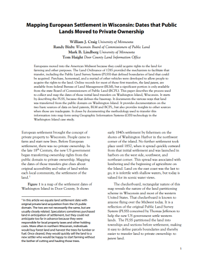
| Mapping European Settlement in Wisconsin | This study of washington Island was presented by Will Craig at the WLIA (Wisconsin Land Information Association) Fall Regional Conference in Oshkosh in October, 2015. The study focuses on the processes used to collect and map the dates of initial land transfers on Washington Island, Wisconsin. | 11/13/2015 |
| V1 Interim Report and Digital Appendices | Interim report of the V1 Statewide Parcel Map Database Project (V1 Project). The V1 Project is a collaboration between the State Cartographer’s Office, the Wisconsin Land Information Program (WLIP), and local governments. This report describes the V1 Project, part of the Statewide Parcel Map Initiative established by Act 20 of 2013. | 06/30/2015 |
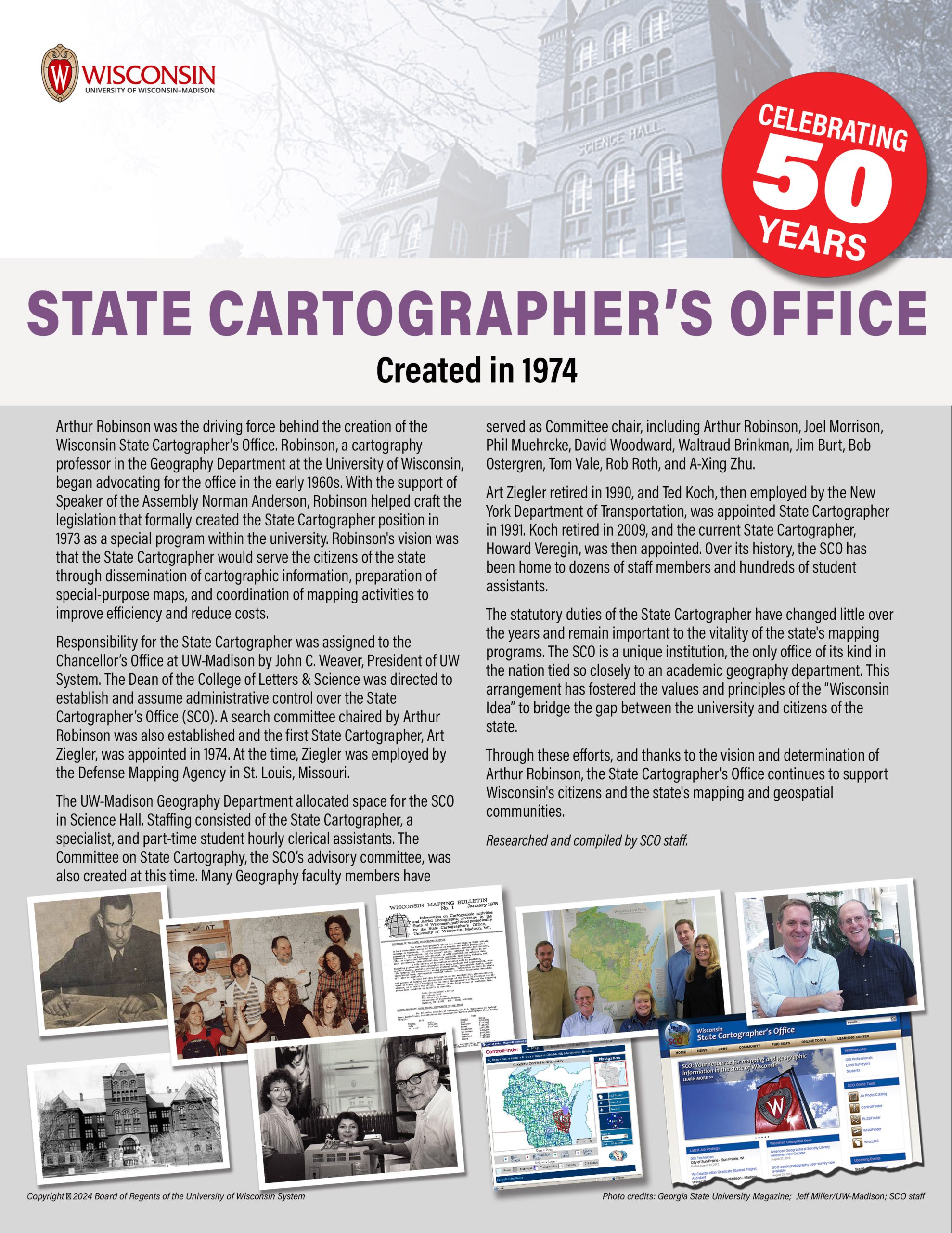
| History of the State Cartographer’s Office | A synopsis of the formation of the State Cartographer’s Office (SCO) and the role played by Arthur Robinson. | 09/25/2024 |
| Final Report, A Day with Your County Surveyor | Report on a public forum entitled, “A Day with Your County Surveyor,” hosted by the Wisconsin State Cartographer’s Office on April 3, 2017, in Wisconsin Dells. | 04/28/2017 |
| Understanding Elevation | Primarily targeted at geospatial professionals who want want a better understanding of elevation terminology, this Infosheet describes the differences between ellipsoid heights and elevations (orthometric heights), and the implications of the National Geodetic Survey’s GRAV-D … | 01/06/2012 |