
 We offer a variety of digital outline maps for use in various graphics, illustration, or office software. The map graphics available for download have been derived from several common layers of digital GIS data. All of the statewide GIS data layers used were processed by state agencies and exist in the Wisconsin Transverse Mercator coordinate system.
Of the formats below, Adobe PDF files are generally best for printing. Each of the counties in the Adobe Illustrator (AI) file type is encoded as a closed polygons. Therefore, individual counties can be selected, filled with colors and patterns. The remaining types (TIFF, PNG) are standard graphic formats that can be opened in most graphic viewers, editors, and word processors.
These files may be used freely without restriction. Credit to the State Cartographer’s Office is appreciated.
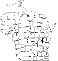
| Map Title | TIF | PNG | AI | |
| County Outlines | 346Kb | 175Kb | 25Kb | 291Kb |
| County Outlines with County Names | 583Kb | 859Kb | 38Kb | 474Kb |
| County Outlines with Major Waterways | 784Kb | 216Kb | 34Kb | 743Kb |
| County Outlines with Major Waterways and County Names | 1.1Mb | 1.4Mb | 60Kb | 790Kb |
| County Outlines with Open Water | 1.49Mb | 375Kb | 60Kb | 1.5Mb |
| County Outlines with Major Highways | 704Kb | 383Kb | 78Kb | 604Kb |
| State Outline | 180Kb | 133Kb | 19Kb | 125Kb |
| State Outline with Major Waterways | 622Kb | 176Kb | 28Kb | 583Kb |
| State Outline with Open Water | 1.4Mb | 338Kb | 52Kb | 1.4Mb |