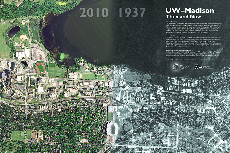
This image of the University of Wisconsin–Madison blends a modern color photograph from July 2, 2010, with an historic black and white photograph from July 6, 1937. The photographs show the campus across a span of 73 years. To construct the image, the 1937 photograph was georeferenced to the 2010 photograph using Geographic Information System (GIS) software. The 1937 and 2010 photographs were both acquired by the US Department of Agriculture. A digital, scanned copy of the 1937 photograph was obtained from the Wisconsin Historic Aerial Image Finder, a joint project of the State Cartographer’s Office, the Robinson Map Library (UW–Madison Department of Geography) and the UW Digital Collections Center. A copy of the 2010 photograph was obtained from WisconsinView.
Download Publication (8 MB)

