
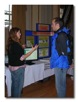
Participant at a DNR Booth
On November 16th the UW-Madison Department of Geography held the third-annual GIS Day Expo at the Memorial Union. Forty organizations were on hand to demonstrate how Geographic Information Systems are used for planning, analysis, management, problem-solving and education. UW students and faculty/staff, local and state agency employees, area high school students and members of the general public attended the event.
The Expo once again consisted of exhibitor’s booths, a map gallery and a speaker seminar.
Twelve presentations where given. Topics ranged from a basic introductory GIS talk to discussions of GIS applications in a variety of fields to demonstrations of new GIS tools and resources. There was a special presentation by the new state Geographic Information Officer (GIO), Dave Mockert, on a vision for GIS in Wisconsin.
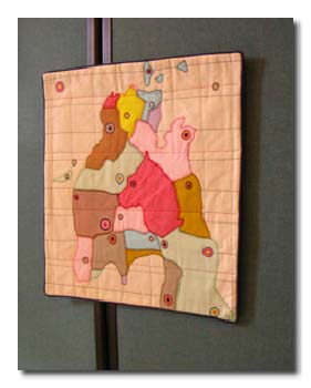
Map Art: Textile Wall Hangings by Leah Evans
This year, the Geography Club organized a “Where in the World?” contest with aerial photographs from the Robinson Map Library. The club donated their infamous Geography Club Cow T-shirts to the 3 winners (a three-way tie of perfect scores!). Club president and contest organizer Ben Spaier reports that next year’s contest will have to be a lot harder for this geographically savvy crowd.
Another new feature of the Expo was an exhibit by Madison artist Leah Evans of quilted maps, bringing the high tech in contrast with “primitive” artistic rendering of maps and satellite imagery.
The event ended with a door-prize drawing of many fabulous prizes donated by the following participating organizations: UW Land Information Computer Graphics Facility, UW Environmental Remote Sensing Program, the State Cartographer’s Office, the National Park Service, UW-Aquatic Sciences Center, ESRI, Leica Geosystems, Mapping Specialists and the GIS Certificate program and Geography Club.
For more information and a list of all participants see: www.geography.wisc.edu/GISDay.