
This is a common question that we receive each spring as fishing season approaches. While there is no single “best” source we can suggest, there are a number of options you can explore.
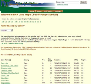
First, the most comprehensive source of bathymetric (depth contour) lake maps comes from the Wisconsin DNR. Visit the DNR Lakes page, and choose a county from the dropdown box near the top of the screen. Then, choose a lake from the list to view a scanned version of a paper lake map. Cartographically, the DNR maps are not very pleasing to the eye, and some maps date back to the 1940’s. If you would like a printed version of a DNR map, visit the Clarkson Map Company. Note that the maps distributed by Clarkson are not enhanced in any way over the standard DNR product.
Three commercial outfits in Wisconsin also produce lake maps. If you would like a nicely polished cartographic product, Mapping Specialistsin Madison produces a series of maps for nearly 200 popular Wisconsin lakes. Their maps use a nice shaded relief effect to enhance the appearance of bathymetric data, and include supplementary information such as stocking and plant life data, and notes from local fishing guides.
Fishing Hot Spots (FHS) in Rhinelander, a widely-known producer of lake maps throughout the U.S., lists just over 200 Wisconsin lake maps on their website. In addition to their paper maps, FHS has partnered with several major GPS receiver manufacturers to make their products available on mapping-capable GPS receivers.
Sportsman’s Connection in Superior has two products of interest. The first is a series of six regional guidebooks that cover Wisconsin. In addition to bathymetric maps, each guide contains a wealth of local fishing information and DNR stocking and survey data. They also produce a CD-ROM containing over 1000 lake maps in digital format.
Finally, also worth mentioning is the popular Delorme Atlas and Gazetteer of Wisconsin. Although the relatively small scale of the atlas (1:150,000) does not lend itself to showing a great amount of detail, the Delorme maps are perhaps the best source of public boat landing locations throughout the state.