
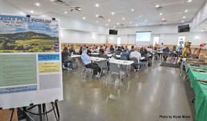
On May 15, 2025, the Wisconsin County Surveyors Association, in conjunction with the PLSS Workgroup, held the 2025 PLSS Forum in Richland Center, Wisconsin. It was a day of learning and discussion for the 51 attendees, focused on the important role of the Public Land Survey System (PLSS) in Wisconsin and why its ongoing maintenance and management are essential. The event was attended by county board members, land surveyors, county officials and landowners. The event was supported by the Wisconsin Society of Land Surveyors (WSLS), WSLS Foundation and the Wisconsin State Cartographer’s Office.
The PLSS Workgroup was formed by individuals and organizations in Wisconsin to advocate and advance the purpose and importance of the PLSS. Their goal is to educate and encourage state, county and municipal agencies in improving, advancing and maintaining the PLSS statewide.
The PLSS serves as the cornerstone of our state’s property ownership framework. Without a properly maintained network of PLSS corner monuments, there is an increased risk of property disputes, inequitable taxation, disagreements about resource rights, confusion over easement locations, and unnecessary expenditures by private citizens and local governments.
The forum offered presentations covering a wide range of topics, including the history of the PLSS, the duties of County Surveyors, and maintenance programs designed to protect and preserve the system. Attendees also learned about the Wisconsin Land Information Program (WLIP), which provides funding that counties can use for PLSS remonumentation and maintenance efforts.
Presentations included:
The Beginnings of Land Division in Wisconsin and Michigan
The County Surveyor: Current Duties, Research & Resources
PLSS Monuments, Maintenance & Coordinates
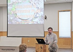
Wisconsin Land Information Program & Building a Statewide PLSS Layer
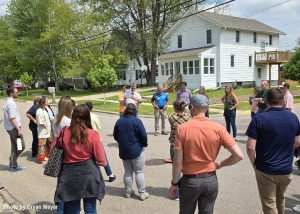
After lunch (sponsored by the Wisconsin Society of Land Surveyors) participants visited a local PLSS corner about two blocks from the venue. This hands-on experience allowed them to see firsthand how a PLSS corner is documented on a tie sheet and to observe the associated witness monuments, which can aid in re-establishing the corner if it is ever destroyed.
The day concluded with a lighthearted round of PLSS Jeopardy, where attendees tested their knowledge on a variety of topics covered throughout the forum.
The PLSS Forum is an annual event. Stay tuned to the State Cartographer’s Office website for information about the 2026 PLSS Forum.
Thanks to Bryan H. Meyer, La Crosse County Surveyor, for photos and additional text.