
As geospatial professionals, we sometimes lose sight of the everyday value that online maps provide to the average consumer. Thanks to an ongoing evolution of technology, geospatial information is becoming more accessible to the public for a wider-range of interesting uses. In this article I will provide a quick overview of some of the latest web sites designed to assist with common spatially-related tasks.
Where am I and what’s around me?
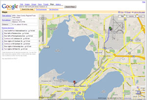
Navigation aids are perhaps the most common spatial tool utilized by the general public. To obtain directions to a friend’s house, you can use several online mapping applications designed to give directions. The most popular include MapQuest, Google Maps, Yahoo! Maps, and MSN Maps. Each has a different look and feel, but they generally provide similar results.
These services, once only available on the web, are now accessible via cell phones and in vehicles. Mobile GMaps is a free application that allows you to view the major online mapping websites on your phone. Google Maps and MapQuest also have built-in features on their websites that adapt their services for cell phone use. Vehicle navigation systems are also becoming more popular, and significantly less expensive than only a few years ago. Once considered a luxury item for high-end cars, today many automobile manufacturers are installing these systems in vehicles driven by the rest of us!
These tools provide increased awareness of location and proximity, helping users travel more efficiently and directly. The same information used to locate and direct users is also being incorporated into spatial searches for businesses and people. Utilizing the latest technology, a service called Loki can determine your location and provide information about the nearest restaurant of your choice. If you would like to join a friend for lunch, uLocate, Dodgeball and Rabble will show you which friends are nearby.
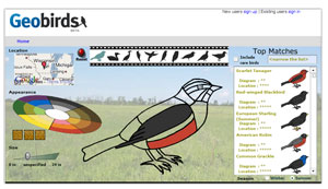
And for you birdwatchers, GeoBirds is a site that lets you identify an unknown bird species by selecting your location on a Google base map. Once your location is identified, the results are automatically narrowed to birds most likely to be found in the selected area. From there, you can select bird sizes, shapes and colors to further refine the results.
Sharing with Others
As a member of an area running group, I often receive e-mail messages announcing runs and routes. Instead of a complicated written description of a route, the organizer sends a link to a customized map created with Gmaps Pedometer. MapMyRun and MyOutdoors are other examples of sites where you can create customized maps. These sites allow a user to plot out their running, biking or hiking course, view route elevation, measure distances, calories burned, and more.
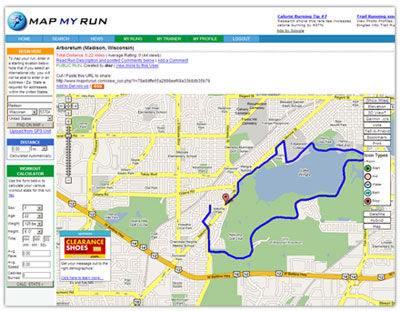
MapMyRun has the capability to save, search and share routes with friends. Additionally, you have the option of subscribing to a RSS feed of a particular person’s runs. This allows a user to learn of new content in real time without visiting individual sites to check for updates.
From Professional to Practical
These technologies go by many names but they have one thing in common: they are adding a spatial element to knowledge. Online maps have become more useable in recent years, and tools once limited to professionals have evolved into practical tools used by the general public. Efforts to simplify interfaces and deliver the most current and accurate data have achieved the confidence and interest of the public user.
The emergence, or some would say explosion, of customizable maps is the result of companies like Google and Yahoo! publishing their Application Programming Interface (API). These APIs are scripting interfaces that allow people to integrate Google or Yahoo! maps into their own websites.
I’ve only scratched the surface of geospatial tools available on the internet. I invite you to explore these sites, and you will surely discover many new geospatial services and applications!