
For more information, visit the exhibit Web site.
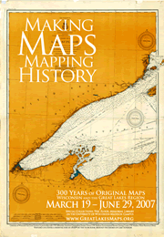
More than 30 original maps illustrating the evolution of mapmaking in the Great Lakes region over the past 300 years are on display through June 29th as part of a special exhibit at UW-Madison.
The exhibit features a mix of “old and new”, including French maps from the late 1600’s, all the way up to modern satellite imagery processed by the UW Environmental Remote Sensing Center in 2006.
An audio commentary for selected maps is available on two loaner iPods to guide visitors through the display. For anyone not able to visit Madison, the podcasts can also be found on the Great Lakes Maps Web site.
As part of the exhibit, Christopher Baruth, Curator of the American Geographical Society Library, will offer a public lecture on “The Early Mapping and Charting of the Great Lakes” on April 5th at 4 p.m.
Open weekdays from 9 a.m. to 5 p.m., the exhibit is located in the Special Collections area (9th floor) of the UW-Madison Memorial Library.