The Wisconsin State Cartographer’s Office (SCO), in collaboration with the Capital Area Regional Planning Commission (CARPC) and other partners, hosted GIS workshops this summer for two youth employment groups – Powerful Teen Leaders (PTL) and Maydm.
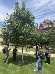
PTL students and mentors collecting field data on the UW-Madison campus.
PTL is a summer youth employment program for Northside teens in Madison. The program serves young people furthest from resources and opportunities who face systemic barriers to employment. It includes workforce experience and readiness training with a particular focus on future employment in the green jobs economy. PTL is a program within Sustain Dane, whose mission is to inspire, connect and support people to accelerate equity and sustainable actions for community well-being.
Maydm provides girls and youth of color in grades 6-12 with the skills, experiences and connections to pursue careers in and change the face of STEM. Maydm’s vision is a world where all students know that a career in STEM is possible for them and where all students can pursue their dreams as entrepreneurs, developers, engineers, professors and more.
This is the SCO’s second year working with PTL students and our first working with Maydm. In 2025, the SCO hosted a group of eight PTL students over three days. A description of that workshop can be found here.
This year, the SCO hosted nine PTL students over two days. The first day was spent in the classroom and the field, learning the principles of cartography and GIS and collecting data on the UW-Madison campus.
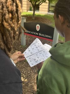
PTL students using a field guide to identify trees on the UW-Madison campus.
On the second day, students used the UW-Madison Department of Planning and Landscape Architecture’s (DPLA) computer lab to access ArcGIS Online (AGOL) for analysis of the data collected on the first day. Students also had time to create their own maps using Google My Maps and were able to see how that data could be integrated into AGOL.
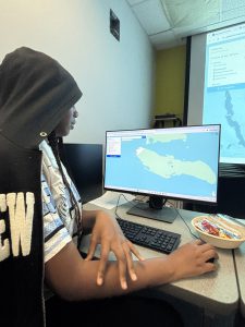
PTL student exploring online mapping tools.
For the Maydm students, the workshop was spread over three days. The first day, held at the Goodman Community Center on Waubesa Street in Madison, introduced the 27 students to basic principles of cartography and GIS.
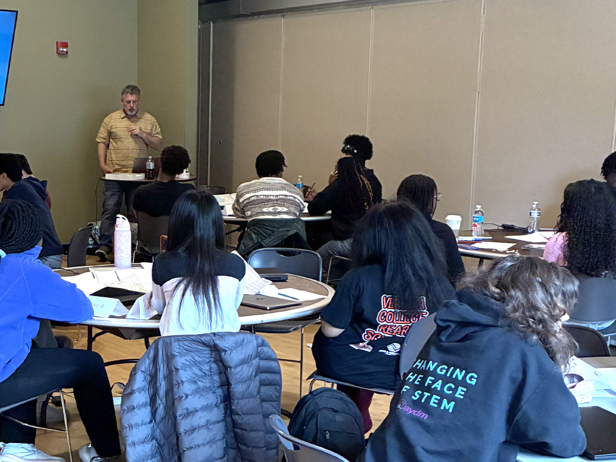
The SCO’s Mike Hasinoff talks to Maydm students about maps and GIS.
On the second day, students visited Empire Prairies Westport Drumlin State Natural Area, a 227-acre restored wildlife area near Waunakee managed by Groundswell Conservancy. Here, students broke into groups to collect plant species information along transects on a glacial drumlin landform. Data were collected using an Esri Survey 123 app. On the third day, at Madison College, students learned how the data they collected was visible and usable in AGOL. Laura Hicklin, Director of Dane County Land and Water, was also present to talk to Maydm students about environmental careers.
Maydm students collecting data at Empire Prairies.
The SCO has been working with youth groups for several years. In 2024, the SCO hosted a group of Conservation Academy crew members from Operation Fresh Start for training in GIS. OFS is a regional leader in providing alternative pathways for young individuals from disadvantaged communities. OFS’s Conservation Academy Program aims to provide young adults an opportunity to gain experience in an environmental career, mainly through restoration efforts such as tree planting, invasive plant removal, pesticide application and prescribed burning. The SCO training included work at Starkweather Creek on Madison’s east side, under a grant from Water@UW-Madison and the Office of the Provost. The creek is historically one of the most polluted waterbodies in the greater Madison area.
In 2026-27 we will work with Environmentalism and Project Green Teen students at Malcolm Shabazz City High School in an ongoing effort to monitor chloride in the creek. Shabazz is an alternative public school committed to learning through environmental education. Shabazz students will engage with a critical environmental issue through active participation in the chloride monitoring effort and training in cartography and GIS for environmental applications.
These training efforts represent the “Wisconsin Idea” in action, coupling UW-Madison staff and faculty with local government units responsible for environmental planning, community groups with connections to local residents, and high school students who can be the next generation of environmental scientists.
Acknowledgements
The efforts of the SCO are possible only through the support of a wide spectrum of sponsoring agencies, volunteers, collaborators and partners.
Matt Noone, Melissa Michaud, Liz Levy and Jason Valerius — CARPC
The Starkweather Creek Technical Committee, comprising members from CARPC (including Salt Wise), Friends of Starkweather Creek, City of Madison Engineering, Dane County Land and Water, the US Geological Survey, the Rotary Club and the Division of Extension, Department of Chemistry, Department of Planning and Landscape Architecture (DPLA), School of Human Ecology and Center for Limnology at UW-Madison.
Jake Norman, Marcus Johnson and Cory Rich — Operation Fresh Start
BJ Byers and Sam Douglass – Groundswell Conservancy
Asia Pfeifer and Lennise O’Dwyer — Maydm
Spencer Bierman, Sonali Bhikha and Kathryn Marek — Sustain Dane
Laura Hicklin — Dane County Land and Water
Carey McAndrews — DPLA
Tino Kaltsas and Andrey Nevinskiy — Department of Geography, GNP IT
Heather Boylan – UW-Madison Office of Youth Protection
PTL and Maydm training was supported by an Alliant Energy Foundation grant to CARPC.
OFS training was supported by a grant from Water@UW-Madison and the University of Wisconsin-Madison’s Office of the Provost.
Shabazz training will be supported through a grant from the Evjue Foundation.