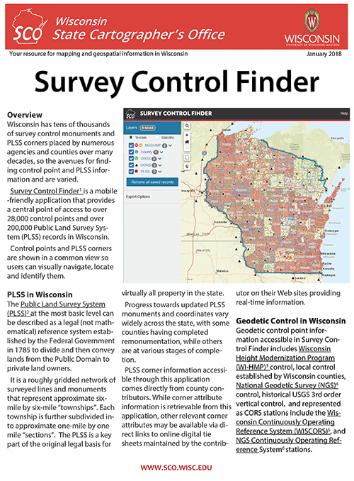
WiscLinc subtitle

Wisconsin Ramona Survey

Participation
The Wisconsin Ramona on-line geographic data inventory tool is here!

Sign in, create your user and organizational profile, enter information about your data, and learn about your Wisconsin neighbors. We've created a draft User Guide to help you get started.


The Wisconsin Ramona GIS Inventory is simple to use. It provides a way to list your data sets with sufficient detail to be of service to others, while you painlessly create your first building block toward a metadata record. Everyone looking for data can log in, find data contacts and use status maps. With your active participation, RAMONA will soon become the resource for geographic data discovery in and around Wisconsin.

Advantages of the RAMONA on-line inventory tool for Wisconsin:

  • Easy to use, uncluttered, and logical organization.
  • Multiple users within a single organization can each complete the inventory for the specific data sets they create and manage.
  • My Geography section allows respondents to select multiple states, or multiple counties/cities if they produce and manage data for regional areas.
  • Directory of Wisconsin data providers can be queried by organization name or type, individual’s name, or application area. The Directory cannot be mined for spam emails or harvested by spiders.
  • Users pick from drop-down lists to specify scale, status, source, year, and update frequency for each data layer, and provide a short abstract and/or metadata link.
  • Statewide status maps can be generated for a given theme.
  • An initial building-block for metadata records is created automatically and available for you to expand upon later. All inventory respondents will indicate if they are already producing FGDC-compliant metadata.

The RAMONA national data inventory tool was developed to inventory the GIS data holdings of tribal, state, and local governments, and their partners. It provides one consistent platform for the nation that is designed to work in concert with the federal Geospatial One Stop (GOS) portal. RAMONA was created by the National States Geographic Information Council (NSGIC) under a grant from the National Oceanic and Atmospheric Administration (NOAA). Although it is a national inventory, it is customized for use in Wisconsin.

Guides and Presentations

 
Ramona and WLIP Annual Survey Comparison Study - 2006/07

WLIP Survey - 1999-2003
Every year the State of Wisconsin Department of Adminstration hosted a Wisconsin Land Information Program(WLIP) Survey filled out by County Land Information Officers (LIOs). This survey is produced to provide a periodic assessment of the status, progress, and benefits of the WLIP to each of Wisconsin's 72 counties, the Land Information Board and other interested parties.

Below are links to the Surveys, from 1999-2003. (Links open in new browser window)

County Land Information Office Contact List