
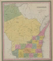
Over 200 of the most-frequently-requested maps of American cities, states, and national parks from the American Geographical Society Library (AGSL) at UW-Milwaukee form the core of a new online digital library.
Some international maps are available as well, and more will be added to the collection. The current selection ranges from historical maps of Milwaukee and Wisconsin to topographic maps of California and Hawaii.
The digital library includes thumbnail images. Clicking on the thumbnail leads to a high-resolution image that allows users to zoom and pan. Users can search the collection by geographic location, publication date, and subject headings.
The collection was created by an AGSL team led by Tom Brittnacher; Digital Collections Librarian Krystyna Matusiak and other members of the Digitization Unit; and Joe Tomich.
Take a look at the collection and see the future of map libraries. AGSL’s paper collection will not disappear; but a digital library provides worldwide, 24/7 access to AGSL maps.