
The Landsat era that began in 1972 will continue with the launch of Landsat 8 next month. Technically, the Landsat 8 mission is known as the Landsat Data Continuity Mission (LDCM); the satellite will be named Landsat 8 after launch.
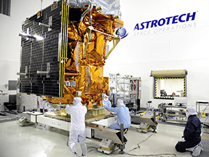
Technicians checking out Landsat 8 satellite.
Image Credit: NASA, Dec. 21, 2012
The satellite’s launch has long been anticipated due to the deteriorating health of other Landsat satellites. Landsat 5, launched in 1984, was recently decommissioned following degradation of electronic components on board the satellite. At almost 30 years of age, Landsat 5 is the longest-operating Earth observing satellite mission in history, long outliving its three-year design life. Landsat 7, launched in 1999, has also outlived its design life, but the satellite has limited capabilities due to the age of the system.
Landsat 8 contains two sensors, the nine-band Operational Land Imager (OLI) and the 2-band Thermal Infrared Sensor (TIRS). OLI has 30 meter resolution (with a 15 meter panchromatic band) in the visible, near infrared, and short wave infrared portions of the spectrum. TIRS has 100 meter resolution, and is sensitive to two thermal infrared wavelength bands, helping it separate the temperature of the Earth’s surface from that of the atmosphere.
These resolution levels are in line with earlier Landsat sensors and reflect the ongoing role of Landsat in providing a synoptic view of the environment. The entire earth will fall within view once every sixteen days due to Landsat 8’s near-polar orbit.
For more information see the USGS Landsat mission page. A useful and detailed brochure is also available.
Also check out the LandsatLook Viewer to view and download Landsat scenes. There is also a help page for the viewer.