
A statewide layer of 2020 block-level census data for Wisconsin is now available on Geodata@Wisconsin. A direct link to the layer is here. The Geodata@Wisconsin app with all other Wisconsin geospatial data is here.
The statewide layer contains 2020 redistricting data as reported by the U.S. Census Bureau for Wisconsin. The attributes come from the 2020 Public Law 94-171 (P.L. 94-171) tables. Esri downloaded the data from the census FTP site, imported it into SAS format and joined to the 2020 TIGER boundaries. All census tables were merged to create a single table containing all attributes. Esri published the layer online (for the entire country) here as a map service. The service was downloaded county by county and appended to create the statewide layer. With Esri’s assistance, the layer has been made available in geodatabase format for download from Geodata@Wisconsin.
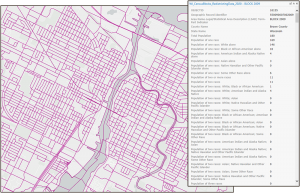
There are over 200,000 polygons in the layer, each representing a block. Blocks are the smallest unit of geography published by the Census Bureau.
There are several hundred attributes in the layer. The vast majority of the attributes relate to population and race, including the population identifying as each race as defined by the Census Bureau, the population identifying as two or more races, the population identifying as three or more races, etc., the Hispanic or Latino population by race, and the population 18 years and older by race. Attributes also give statistics for housing units and group quarter populations. There are also a plethora of attributes to allow the data to be aggregated by county, minor civil divison, place, census tract and block group.
This data is intended for reference and mapping purposes, and may be used for basic applications such as viewing, querying and map output production, or to provide a basemap to support graphical overlays and analysis with other spatial data.
Additional information about the layer can be viewed in the metadata attached to the layer. The metadata includes a description of several fields dropped, renamed or added by Esri.
Note that to protect the privacy and confidentiality of respondents, the Census Bureau uses differential privacy techniques. This means that some individual blocks will have values that are inconsistent or improbable. However, when aggregated up, these issues become minimized.