
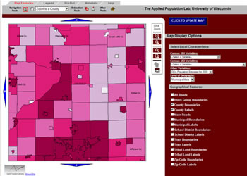
A new online mapping application developed by the University of Wisconsin-Madison Applied Population Lab (APL) is a nice alternative to acquiring population data from the U.S. Census Bureau. The APL “GetFacts” web application is a great tool for interactively visualizing and downloading TIGER Line shapefiles, U.S. Census population data, and WI Department of Administration population projections.
There are multiple options for downloading data from GetFacts. You can grab an entire statewide data set, a selected county, or the extent of the map as viewed on-screen. Data are delivered as a zipped ESRI shapefile, with only those attributes that you select appended in the accompanying database file.
A list of available 2005 TIGER shapefiles can be viewed by clicking on the tiger icon near the top of the screen. Examples of downloadable shapefiles include: Census Tracts, Census Block Groups, Unified School District Polygons, and American Indian/Alaska Native/Hawaiian Homeland Area polygons. For more information on the data available in GetFacts, visit the Metadata tab.
Next time you need census-related data, GetFacts is definitely worth a look.