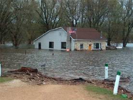
Rural Grant County, WI was flooded by the Mississippi River that affected more than 2,000 homes in April, 2001. (Image courtesy of FEMA’s Photo Library)
The Department of Natural Resources (DNR) and the Wisconsin Land Information Association (WLIA) co-sponsored a workshop last month (July 27th) in Wisconsin Rapids related to the Flood Map Modernization Initiative with over 40 in attendance. Information was provided on what data sets are the most important and specifically what counties, cities, and villages could do to get ready for when Federal Emergency Management Agency (FEMA) funding is approved for their county. Speakers included: Alan Lulloff, DNR, Fred Halfen, Ayres Associates, and Ed Dickson, Watershed Concepts.
Flood hazard maps produced by FEMA are one of the basic and essential tools for flood insurance, floodplain management and flood hazard mitigation. However, due to the manual cartographic processes used and limited topographic information available when they were initially developed, today’s flood hazard maps are inadequate to meet current needs. FEMA has established a broad goal of modernizing flood hazard maps nationwide over the next 5 years and has developed a Flood Map Modernization Plan that has been funded by Congress. The DNR has received approval from FEMA to manage the Flood Map Modernization initiative in Wisconsin.
Due to the Strategic Initiative Grant for Floodplain Mapping approved by the Wisconsin Land Information Board last year, Wisconsin got funding earlier than most states. The fact that they had detailed topographic data or a had large population at risk, Waukesha, Dane, Ozaukee, Milwaukee, Washington and Rock Counties received Strategic Initiative Grants. As a result, these were among the first counties in the nation to be funded by FEMA.
A typical county map modernization project might involve the county contributing data sources such as digital building footprints and detailed topographic data and engineering expertise, the WDNR offering engineering support and technical expertise, and FEMA providing map production and engineering review. In addition to base mapping (digital orthophotography, roads, municipal boundaries, and geodetic control) topographic data and bridge/culvert data on flooding sources significantly impact the quality of a county’s updated floodplain maps. While no local contributions are required in this floodplain remapping effort, local GIS data and the Strategic Initiative Grants have a significant impact on the quality of the final product and how soon the maps will be redone in a county.
Web resources available
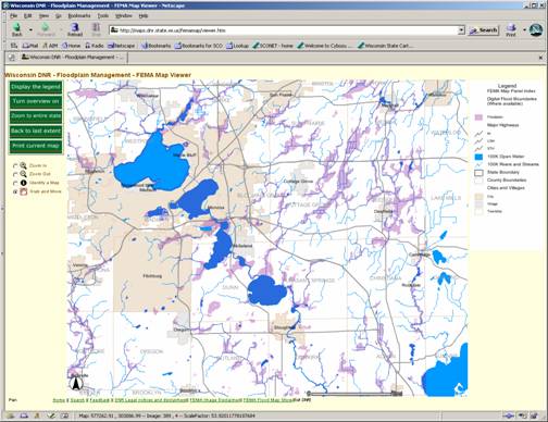
Wisconsin’s Floodplain Management Program