
As part of the federal government initiative to move from print to electronic publications, the United States Department of Agriculture (USDA) Natural Resources Conservation Service (NRCS) launched their Web Soil Survey site in August 2005. In the past, soil survey maps were available as printed books available in libraries or NRCS field offices.
Users benefit from the convenience of online access, and have the option to download or save a soil map for their area of interest. In addition to soil survey maps, the site includes a wealth of background material on soils.
The Web Soil Survey has three main sections, shown as tabs along the top of the main page. The “Area of Interest” tab is used to select the area the user wishes to explore. The “Soil Map” tab displays the soil map for that region.
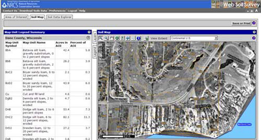
The “Soil Map” view showing soils and their characteristics for the selected area.
The “Soil Data Explorer” tab allows the user to learn about particular land use and soil properties such as soil erosion probability, drainage, and pH. In addition, it’s also possible to generate a suitability report for specific landuse categories such as playgrounds, golf courses or waste management sites.
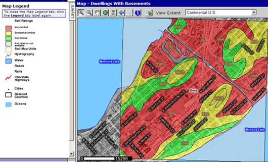
Construction suitability for dwellings with basements on the isthmus in Madison.
While the Web Soil Survey already performs a variety of useful functions, the NRCS has plans to extend this functionality. In the future, users will be able to save a profile for quick access to their saved properties. The addition of a scale bar, zoom function, and the possibility to use township, section and range to navigate the map are also planned.
Link: Web Soil Survey