
For more information
Department of Tourism Official Snowmobile Trail Map (5.57 MB)
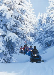
Snowmobile trails, by their very nature, can be difficult to map. Trails often cross privately-owned land, trail routes can change from year to year, and variable weather conditions will easily shut down a trail segment with little warning.
That said, there are several options to explore.
U.S. Trailmaps is a relatively new Wisconsin company that claims to have mapped 70,000 miles of U.S. trails in a format compatible with Garmin and Magellan GPS receivers.* Their “TrailPlan” product line for Magellan users is available on Secure Digital (SD) cards, and covers 27 states. Garmin users are currently limited to trail maps for Wisconsin, Michigan, Minnesota, and several New England states.
For community-developed maps, visit GPSSledMaps.com. This is a clearinghouse for snowmobile riders to exchange GPS track logs and waypoints. However, offerings in Wisconsin are currently limited to the north-central part of the state.
For an experienced mapper familiar with the technology and not afraid of a little extra work, converting GIS data to a track file useable by a recreation-grade receiver is another option. However, availability of digital trails data is spotty, and varies considerably by location. I suggest consulting the county GIS site for the area where you’ll be riding to determine if digital data are available.
What about paper maps?
The Wisconsin Department of Tourism recently published a 2007-2009 Official Snowmobile Trail Map of Wisconsin. However, according to a person I spoke to at the Department of Tourism, the map is intended primarily as a marketing tool to show the extensive network of major corridor trails in the state. It isn’t intended to be a navigational aid.
Since local snowmobile clubs take on the responsibility of maintaining the trails, most larger-scale mapping is typically coordinated by county snowmobile alliances and/or the clubs. While much of the statewide trail system is self-funded through gas taxes and registration fees, many more miles of trails are maintained at club expense. The maps created by clubs are actually a significant source of income through paid advertisements appearing on the maps.
The Association of Wisconsin Snowmobile Clubs (AWSC) keeps an inventory of maps for all counties in Wisconsin, or you can contact a local club directly in most cases. Local chambers of commerce typically have maps on hand as well.
Finally, Sportsman’s Connection produces their “All-Outdoors Atlas” for Minnesota and Wisconsin.* In addition to snowmobile and ATV trails, these atlases also include other information useful to outdoor enthusiasts, such as hiking and biking trails, public hunting areas, and canoeing routes.
Safety first
In researching this question, it hit me how important new technologies like wireless e-911 and GPS are for snowmobile riders in Wisconsin, or anywhere for that matter. Consider that many trail users are from out of state, are likely unfamiliar with the trails they travel, and to make matters more complicated, they may only have a generalized map to guide their way. Knowing where you are is critical should an emergency occur.
This very issue leads to the moral of the story: Do your research before you hit the trail, and understand that trail maps are a general guide only. Always call a local snowmobile club or a local director of the AWSC to get the latest information.
* References to commercial products are for informational purposes only, and do not constitute an endorsement by the State Cartographer’s Office.