
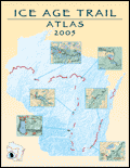
The 100-page 2005 Ice Age Trail Atlas is now available from the Ice Age Park and Trail Foundation (IAPTF). The atlas includes 72 new color hiking maps showing all existing Ice Age Trail segments, the locations of parking areas, toilets, campgrounds, shelters, dispersed camping areas, topography and more. The maps are printed at a 1:48,000 scale (one inch equals approximately ¾ of a mile) in a 8 ½ by 11-inch spiral bound book.
The Atlas begins with a very nice and informative history of previous efforts to map the Trail. The hiking maps are very clean, well designed, and easy to read. Many, but not all, of the maps include latitude and longitude tics for use with a GPS unit. An interesting gazetteer listing prominent places along the Trail is also included.
All proceeds from Atlas sales help support the volunteers who build and maintain the Ice Age Trail. It sells for $20 (IAPTF members) or $25 (non-members), plus $4 shipping and handling. Credit card orders can be made by calling (800) 227-0046.
The IAPTF plans to update the Atlas every 2-3 years.
For more information visit http://www.iceagetrail.org/market/books.html