
[This article was originally posted on the Wisconsin Land Information Association website on July 5, 2019 by Jeremiah Erickson]
On June 26th 2019 the Public Land Survey System Work Group (PLSS Work Group) was acknowledged by the UW-Madison Office of the Chancellor, the Office of Community Relations, the Morgridge Center for Public Service and the Community Partnerships and Outreach (CPO) Staff Network for outstanding community-engaged collaboration in embodiment of the Wisconsin Idea. The PLSS Work Group advocates for improving and maintaining the Public Land Survey System (PLSS) through education.
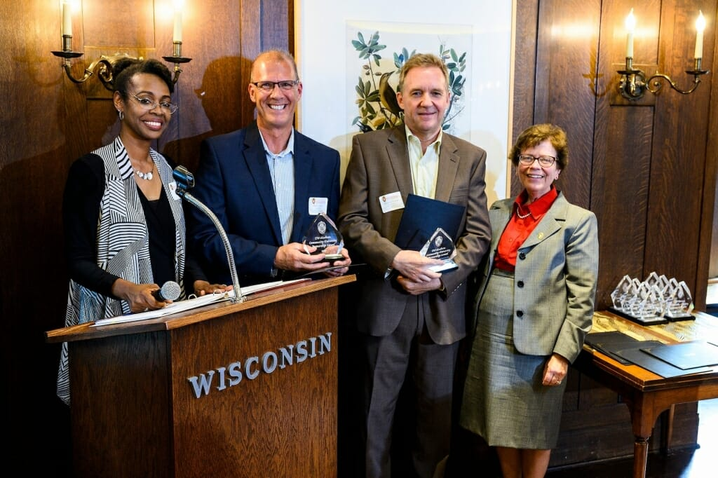
UW-Madison Chancellor Rebecca Blank awarded the 2019 UW-Madison Community-University Partnership Award (CUPA) to members of the PLSS Work Group in attendance at the awards gala. Attendees included Jodi Helgeson, Bryan Meyer, Chris Colney, Howard Veregin, Jeff DeMuth, and Joe Mason — Chair of the University of Wisconsin-Madison Geography Department, who nominated the group. This was in consideration of their project entitled “Uncovering and Discovering Geographical Meaning in Wisconsin’s Rural Landscapes: Outreach and Educational Programming by the State Cartographer’s Office and Public Land Survey System Work Group.”
The partnership has helped citizens understand the significance of the PLSS through educational programming, interactive discussion and hands-on experiences. The efforts of the PLSS Work Group are considered an embodiment of the spirit of the Wisconsin Idea. The programs are held each year in different locations of the state, most recently this past Spring in Darlington, Wisconsin. Programs such as This Land is Your Land, Meet Me at the Corner, and A Day with Your County Surveyor have helped attendees to understand the PLSS and its effects on property boundaries, taxation, and other land related considerations. People also gain understanding in the significance of maintenance of the PLSS and the role of the professional land surveyor and their interaction with other related industry professionals.
Members of the PLSS Work Group currently include:
Howard Veregin, State Cartographer, UW- Madison
Brenda Hemstead, Data Services Specialist, State Cartographer’s Office
Bryan Meyer, WCSA President, La Crosse County Surveyor
Jeff DeMuth, WSLS, Professional Land Surveyor, MSA
Steve Geiger, WCSA/WSLS, Professional Land Surveyor, Polk County
Jeremiah Erickson, WLIA/LION, Monroe County LIO
Jodi Helgeson, WRDA, Adams County Register of Deeds
Brannick Beatse, WRPLA, Monroe County Real Property Lister
Mitch Moline, Enterprise GIS Architect, WisDOT
Chris Colney, LION, Grant County LIO
For more information on the PLSS Work Group see their webpage.
The CUPA application describing the work of the PLSS Work Group can be found here in PDF format.
A UW-Madison new story on the awards ceremony including the other award winners can be found here.
For the original WLIA posting of this story, click here.