
The State Cartographer’s Office (SCO) hosted a one-day forum entitled, “A Day With Your County Surveyor” at Chula Vista Resort in Wisconsin Dells on April 3, 2017. The Forum was made possible by a Statewide Outreach Incentive Grant from the UW-Madison Office of University Relations, a lunch sponsorship by the Wisconsin Society of Land Surveyors, and volunteer support from the PLSS Work Group. The Forum was free to all attendees. A final report on the Forum is now available online.
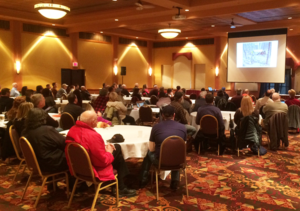
 This forum brought together nearly a hundred geospatial professionals, surveyors, and the general public for a day devoted to understanding the Public Land Survey System (PLSS) and the role of County Surveyors in maintaining this system.
The morning kicked off with a session describing the PLSS and the types of information the professional surveyor researches for locataing an original survey corner.
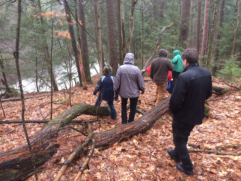
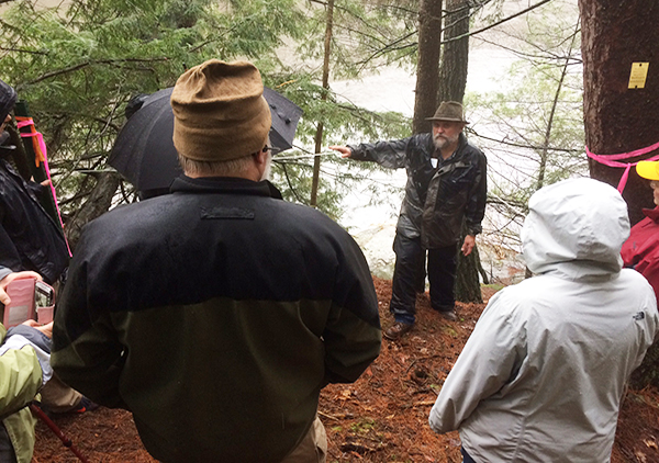
Then, guided by the Adams County Surveyor, attendees took a scenic half-mile walk into the woods along the Wisconsin River to locate an original PLSS corner that was set over a hundred years ago.
The afternoon focused on a session describing what happens after field work, followed by a panel discussion on how newly remonumented PLSS corners are brought into the county’s digital parcel fabric, how the PLSS is used to improve parcel map accuracy, and how this effort can save the county money.
The PLSS Work Group
The PLSS Work Group was formed by individuals and organizations in Wisconsin to advocate and advance the purpose and importance of the Public Land Survey System. The goal of the Work Group is to educate and encourage state, county and municipal agencies in improving, advancing and maintaining the PLSS statewide. More information can be found here.
Next Steps
This was the third PLSS Forum held in the last three years.
Based on comments received on forum evaluations, there seems to be agreement that the surveying and geospatial communities need to continue to communicate, debate their perspectives, and try to identify common interests. With this in mind the State Cartographer’s Office, in consultation with the PLSS Work Group, plans to continue hosting these forums on an annual basis.
These forums help foster the development of a strong professional relationship between the surveying and geospatial communities in the state. While surveyors and geospatial professionals do not see eye-to-eye on all issues, we are fortunate in Wisconsin to have individuals who are willing to expend time and effort educating and explaining their perspectives for the ultimate benefit of the state’s citizens.
There appears to be a growing sense of the importance of PLSS control to maintain accuracy in the parcel network through the state. Given that the Wisconsin Land Information Program is funding county PLSS remonumentation through its Strategic Initiative Grants Program, we sense that there is broad support within the land information community for PLSS investment.
Acknowledgements
The SCO would like to thanks the sponsors of this event: UW-Madison Office of University Relations, the Wisconsin Society of Land Surveyors, and volunteer support from the PLSS Work Group.