
Four current and former students of the State Cartographer’s Office (SCO) presented their research at the 14th Annual St. Louis River Summit in Superior, Wisconsin, this week.
The work they discussed was conducted at the Lake Superior National Estuarine Research Reserve (NERR), a 17,000-acre freshwater estuary in Superior. The NERR’s administrative home is the UW-Madison Division of Extension.
The Summit is a multi-day conference focused on the St. Louis River, which runs along the border between Wisconsin and Minnesota in the Superior-Duluth metro area. The conference provides a forum to discuss strategies for a healthy St. Louis River watershed and attracts over 300 members of the community with education and outreach opportunities. The conference is organized by the Lake Superior NERR and held at UW-Superior.
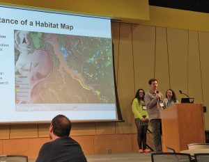
Chris Susnik, Emily Lockling and Christina Dennis presented on the “Lake Superior National Estuarine Research Reserve Habitat Map.” The presentation discussed how a team from the NERR and the SCO spent the summer of 2023 surveying and mapping plant communities within the NERR boundaries to collect training data for remote sensing image classification, which will be used to create a habitat map. Over 1,000 training site polygons covering over 1,000 acres were mapped using a tablet-based Esri Field Maps collection tool. This project was funded through a Wisconsin Idea Collaboration Grant from the UW-Madison Office of the Vice Chancellor for Research & Graduate Education, UW-Madison Division of Extension and WARF.
Chris is a student at UW-Superior and a student assistant in the SCO. He is now working on a related project, “Transferring Lake Superior NERR Habitat Mapping Tools and Methods to the Wisconsin-Minnesota St. Louis River Estuary” funded by the NERRS Science Collaborative Program. More details on this project can be found here.
Emily is a former student assistant in the SCO and a recent graduate of UM-Duluth, with interests and experience in GIS and Environmental Science.
Christina is a former SCO student assistant, a former SCO staff person and is now a graduate student in the Geography Department at UW-Madison.
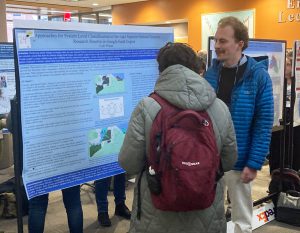
Cole Wilson, another current SCO student, and a graduate student in the Nelson Institute at UW-Madison, also presented in the poster session at the Summit. Cole’s poster, entitled “Approaches for System Level Classification of the Lake Superior National Estuarine Research Reserve in Google Earth Engine” describes his efforts to use Google Earth Engine to produce a prototype habitat map of the NERR using the training data collected over the summer of 2023.
At the poster session, Chris, Emily and Christina also showcased the tools they developed and used to collect data in the field, including a tablet-based Field Map collection tool and an Esri Experience Builder app to review and analyze the data.
All four of the students, while employed by the SCO, worked closely with NERR and other project partners while conducting the research. The grants funding the research are collaborations betwen the SCO, the NERR, several project consultants, and collaborators at UM-Twin Cities and UM-Duluth.