
What was the Bordner Survey?
The Bordner Survey was a massive 1930s-era effort to map land use across the state. The genesis of the project was an attempt to understand the impacts of land use decisions made decades earlier. In northern Wisconsin, most forested land had been cut, and attempts to farm this land often met with failure. By the 1920s, in some northern counties, as much as a quarter of all land could not produce enough income by farming or forestry to cover property taxes.
Remediation efforts required accurate information about land use and land suitability for agriculture and forestry. In 1927, representatives of Wisconsin state government and the University of Wisconsin agreed to collaborate on a detailed land inventory of northern Wisconsin. The effort was led by John Bordner, a Wisconsin farmer who earned a PhD in plant physiology in 1908. Bayfield was the first county completed by the Bordner Survey (technically the Wisconsin Land Economic Inventory). By the mid-1940s, all counties except Milwaukee and Menominee had been surveyed.
The survey’s level of detail was unparalleled. Field workers crossed the state at half-mile intervals, creating hand-drawn maps. These maps were later combined with air photo information to produce a composite map for each six-mile by six-mile township. The maps depicted agricultural and forest cover, including the types of crops grown, and the species, density, and diameter of trees.
Cultural features were also recorded, including abandoned and inhabited buildings, improved and unimproved roads, telephone lines, schools, churches, sawmills, logging camps, mines, and cemeteries, to name a few.
Digitizing the Bordner Maps
The original paper maps from the Bordner Survey have been archived at the Wisconsin Historical Society. The maps have also been scanned by the University of Wisconsin Digital Collections Center and are available online. But, to make these maps more useful, they had to be digitized using GIS.

That effort spanned a decade, given the volume of maps (one per township) and their level of detail. The project began at the University of Wisconsin-Madison’s Forest Ecosystem and Landscape Ecology Lab in the Department of Forest and Wildlife Ecology, under the direction of (now Emeritus) Professor David Mladenoff. Matt Noone, now Senior Environmental Resources Planner at the Capital Area Regional Planning Commission, managed the project, which hired numerous students to perform the arduous digitizing work. Funding for the project was obtained from the UW-Madison Graduate School, the UW-Madison College of Agricultural and Life Sciences, Wisconsin Alumni Research Foundation Research Fund, and the Wisconsin Alumni Research Foundation Kellett Mid-Career Faculty Award.
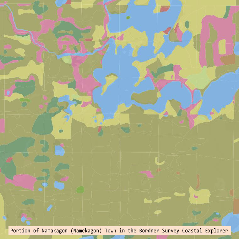
The State Cartographer’s Office (SCO) joined the project a few years later. In 2016 the SCO received a grant from NOAA through Wisconsin’s Coastal Management Program (Office for Coastal Management under the Coastal Zone Management Act, Grant #NA16NOS4190108) to develop a coastal Bordner map database and geoportal for the coastal zones of Lakes Superior and Michigan. Under this grant, Bordner maps were digitized for the Great Lakes watershed and a custom online mapping application was developed.
However, the state was still not completely digitized, with a significant number of counties in the southwest missing. To complete this work, students in the Department of Environmental Sciences and Society at the University of Wisconsin-Platteville, under the direction of Professor Lynnette Dornak, worked on the remaining counties in their GIS courses and in summer internships. Funding was provided by the Wisconsin Department of Natural Resources (DNR), spearheaded by Bob Smail, a DNR Research Scientist.
The final step was to merge all of the disparate pieces of digitized data into one statewide layer, resolve any errors and inconsistencies, and publish the final database. This work has just been completed by the SCO, with additional funding from the DNR.
The Dataset
The statewide Bordner data is available on Geodata@Wisconsin. Geodata, the state’s geoportal, is jointly managed by the Jaime Martindale at UW-Madison’s Robinson Map Library, and the SCO. Polygons are complete across the state except for Milwaukee and Menominee Counties, which were never surveyed. There are over 800,000 unique polygons in the dataset. Points and lines are complete only for a portion of the state. User guide documents for the dataset can be found here.
The current Bordner online mapping app will be replaced with an updated version, hopefully by the end of summer, 2025.
What’s Next?
As noted in the metadata for the Bordner dataset, there are some known issues with the data. A) Paper Bordner maps at county boundaries often depict overlapping areas differently. To construct a statewide layer, a choice had to be made about which representation to use. B) Positional errors along township and county lines may cause slivers to occur. C) Attribute values on either side of a township or county may not be the same. D) Polygon boundaries may not line up perfectly across township or county boundaries. E) Paper maps are not always legible, and judgement calls sometimes needed to be made. We hope to continue to work on these issues and produce a new version of the dataset at some time in the future.
The Bordner data is one of several important historic resources for researchers and the public in the state. Also available is a digital version of the General Land Office survey of the state starting in the 1830s, at the beginning of European settlement. These data include the locations, species and sizes of several hundred thousand witness (or bearing) trees. Work on this database was also directed by David Mladenoff until his retirement, and the data is now managed by the SCO.
Wisconsin is poised to be a leader in the delivery of historic GIS data. In addition to the Bordner and GLO maps, UW-Madison was instrumental in helping the US Geological Survey scan and georeferenced its historic collection of topographic maps, available online at topoView. There are, in addition, untapped historic resources at the Robinson Map Library, the Wisconsin Historical Society, the American Geographical Society Library at UW-Milwaukee, and the Board of Commissioners of Public Lands. These maps provide endless possibilities for GIS analysis and display of historic data for a myriad of uses.
Acknowledgements
A huge thank you to all of those who worked on the project over the years, as well as those who sponsored this large effort!
Additional Resource
John Koch, Touching Every Forty, Wisconsin Magazine of History, 2006.