
The Traffic Information Map
As any Milwaukee-area commuter knows, the Marquette Interchange – the workhorse of the Wisconsin freeway system – is currently being replaced by new structures and roadways. Construction is expected to continue through 2008, and although two lanes of through traffic will be open in all directions for the duration of the project, anyone traveling through downtown Milwaukee would be well-advised to find alternate routes to their destination– one of the many services provided by Mchange.org .
The mchange.org site was the topic of much controversy when it was released in 2004. Critics described the $685,000 development cost for the site as exorbitant, and some even suggested the contract was awarded as a political “favor” in return for campaign contributions. Regardless of the allegations and criticisms, the site does make very interesting use of geospatial technology.
Mchange.org is filled with useful information, including a project guide, news and talk, information on getting around the construction, and traffic information. The “Getting Around” section has three very useful tools. The Planning Guide gives general information and advisories for a variety of travel profiles, from traveling through town to commuting to and from work. The Closure Guide provides a medium-to-long range view of scheduled construction closures so you can plan when you will need to change your travel routes. Perhaps the most useful tool in this section is the Map-it Routing service. By filling out a simple form asking your starting point, destination, travel date, the tool will generate an interactive map and driving directions a la MapQuest.
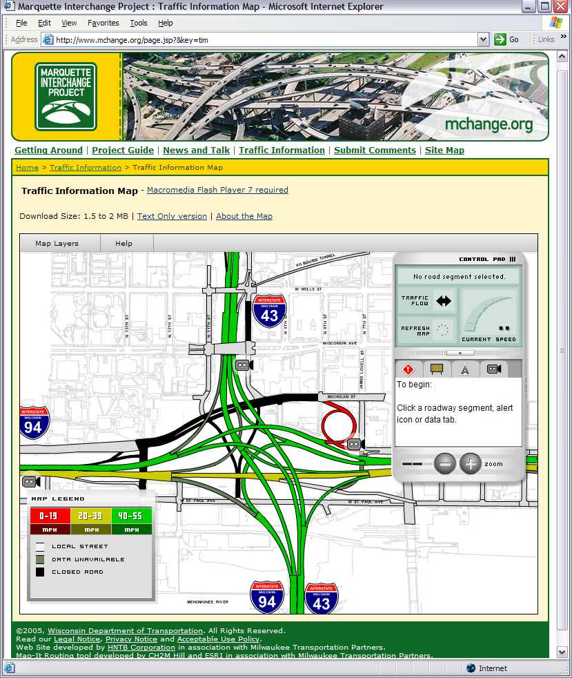
The star of the website, though, is the Traffic Information section. Here is where you can sign up for e-mail broadcasts of traffic alerts and newsletters, view a real-time interactive map of the project site, or download the TrafficBug utility.
The Traffic Information Map is truly impressive. Displaying real-time traffic data from the DOT Traffic Operations Center in Milwaukee, and traffic alerts entered by the Marquette Interchange Project Team, the map shows you ground conditions in a very attractive and easily-understood interface. The map displays the roadway segments in a series of four colors representing traffic conditions: red for 0-19 miles per hour (mph), yellow for 20-39 mph, green for 40-55 mph, and gray when no data is available. You can click on any roadway segment to learn even more: the direction of the traffic flow, the true speed of traffic, traffic volume, occupancy, and a description of the exact situation, all of which are displayed in the moveable control pad.
Also available in the control pad is a series of tabs that each display summary data for their respective objects: traffic alerts, road signs, street segments, and traffic cameras. By clicking any object underneath a tab, the map will automatically move and refocus on that object. If you click on a road sign, the text displayed by that sign will appear in the control pad, and if you click on a traffic camera, a pop-up window with the most recent image from that camera will appear. Navigation is simple, with click-and-drag panning on the map and a four-step zoom in the control panel.
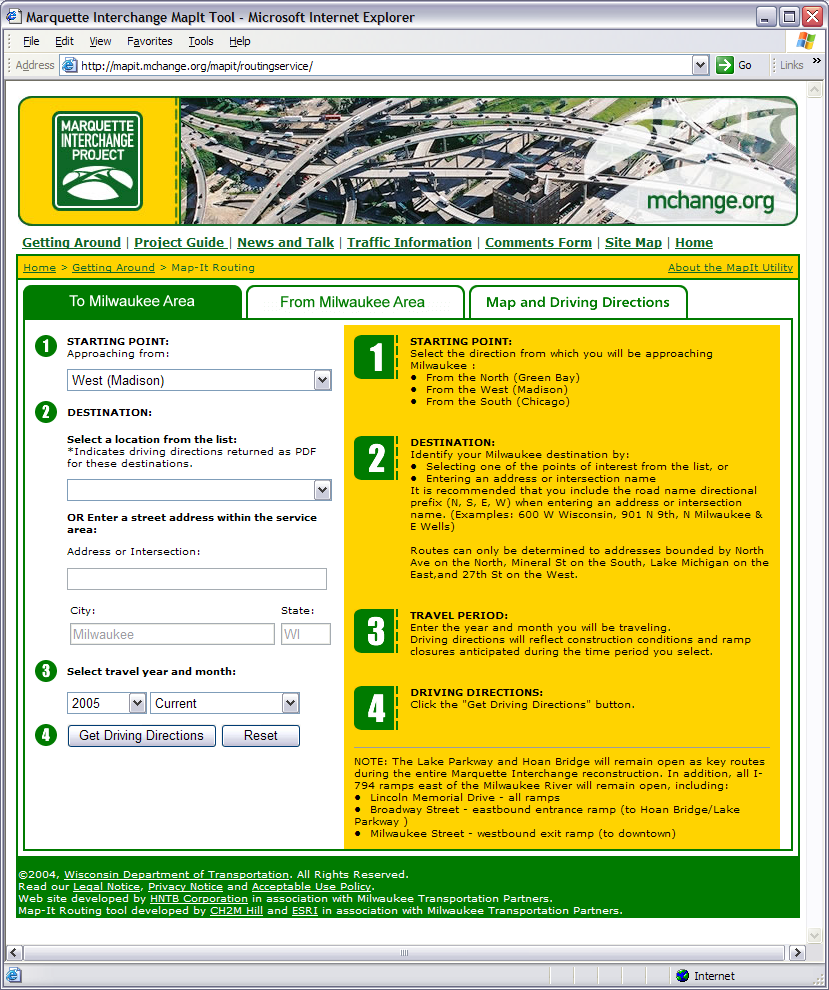
The Map-it Routing service
The map is best viewed with a broadband internet connection, and requires Macromedia Flash player version 7. Otherwise a text-only version of the map data in tabular form is available.
If you live in the Milwaukee area or are planning to travel there in the next few years, I recommend you take a look at Mchange.org. The tools and information available there will likely make your life a little easier during the stressful construction seasons.