
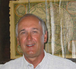
Dave Schmidt, Director of Planning and Zoning for Winnebago County retired on July 1. Deeply involved with land records modernization and GIS applications throughout his 23 years with the county, Dave also served on the state’s Land Records Committee in the late 1980’s, and was among those instrumental in defining the vision of the state’s Land Information Program. A few days before his retirement, we were fortunate to catch a few moments of Dave’s time to have him reflect on the past and comment on the future.
Dave, tell me a little bit about your background. What early experiences in your career formed the foundation for your many future successes in Winnebago County?
After I graduated from UW-Oshkosh, I worked for the Southeastern Wisconsin regional Planning Commission (SEWRPC) for two years, was a planner for the City of Waukesha for a year, and then a city planner in Fargo, North Dakota for 5 years. In particular, I picked up a lot from Kurt Bauer during those early SEWRPC years. From Fargo, I moved on to become the Director of Planning in Linn County, Oregon, located south of Portland. The US Forest service administers half the land in Linn County, and at that time the Forest Service was dabbling with the beginnings of GIS. It was here that I saw the vast potential of this technology.
So, did that exposure later lead to GIS use in Winnebago County?
Yes it did. After leaving Linn County, I returned to Wisconsin to become the planning director for Winnebago County. Soon after arriving, I talked to the county executive about the merits of computer mapping. He agreed to support some of my ideas, ultimately adding $100,000 to the county budget. This occurred in 1982. The first package we bought was from Cor Graphics in Seattle. Seven months after the purchase, the company went out of business. From that misstep, we moved on to using a public domain software package developed by the US Fish & Wildlife Service.
I take it that these early years of using GIS technology, some of them a little rough, set the stage for future successes?
Yes. In the late 1980’s the City of Oshkosh began to look at the merits of GIS. To expand this effort, the county took the lead, and we called on all of the county’s communities to participate. We hired a consultant to do a needs analysis and a cost/benefit study. About the same time, I began to have contact with Ben Niemann and others at UW-Madison, and that led to my participation on the Land Records Committee that developed the recommendations forming the Land Information Program. That experience made me believe a statewide approach to adoption of this technology made the most sense.
So, did all this work within the county lead to something worthwhile?
You bet. In 1990, the county board agreed to finance a $2.6 million bond issue to support the creation of a modern land records system for the county and its communities. This initiative included digital parcel mapping, the conversion of paper-based parcel records to digital form, and digital orthophotos. As participants, each city and village had to contribute by purchasing hardware and software. In all, this was a $4 million initiative.
Dave, garnering that kind of support and involvement is pretty amazing, particularly considering you accomplished this 14 years ago, long before many counties were even thinking about such an effort. How did you do this?
Support from the county board and county executive was absolutely critical. I got Paul Stevenson, our County Executive to believe in the technology. He didn’t necessarily understand it, but he supported me, and he told me many times, “just make it work.” Another critical factor was support from the Planning and Zoning Committee and others. I was the champion, but I convinced others of the merits. When we went before the county board to get approval of the bond issue, I had a variety of people appear before the board in support of the project, including a professor from UW-Oshkosh, representatives from the City Engineering Dept., private surveyors; in all 15 people testified before the board, and the Bond Issue passed on a 37-1 vote!
When I came to Wisconsin in 1991 and got involved in the WLIB, I soon heard about Winnebago County’s WINGS Project. Was the bond issue financing the foundation of this project? By the way, what does WINGS represent?
The acronym WINGS stands for Winnebago Geographic Systems, and yes, the bond issue was the financial beginnings of the project. I might add however, that continued county board support was critical for the project, as was the WLIP funding. The county contributed $300,000 per year to WINGS for staff salaries and other expenses. This allowed us to use WLIP revenues and grant dollars to finance special initiatives such as parcel records conversion, an imaging system for the Register of Deeds Office, and digital orthophotos every three years. It also allowed us to share WLIP funds with other county communities. Communication has been absolutely critical too. We have held monthly GIS meetings with the county’s communities for years – since 1991. I have been blessed with an absolutely great staff. Larry Ellenbecker, Dave Levine, and Diane Culver have been with me for years, and all are extremely dedicated and talented. As you may conclude from this conversation, the WINGS Project is my “pride and joy”, and the accomplishment of which I am most proud.
Quite a legacy I would agree. Now, as your working career comes to an end, what thoughts do you have on the future?
I think the WLIP is at a critical and difficult point. The program has been highly successful for 14 years, but we need to look at some change in direction to meet the challenges of the future. Over the past several years there has been, unfortunately, too much focus on program politics, so, it is time for a new beginning. The young people in our profession(s) are dynamic, they will make things work, I am convinced. The WLIP has a bright future. It may not look the same to us as it does today, but the future is bright none-the-less.
Finally, what are your plans for retirement? Will you continue to work in some capacity?
You know, I have been a professional planner for my entire career, and here I am ready to begin retirement, and I have no plans. To begin, I will just take things day-to-day, but I don’t have any intention to continue working.
Dave, we wish the best to you in your retirement, and thank you so much for your leadership and success in Winnebago County, and for your contributions to the State of Wisconsin.
You’re welcome.