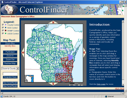
Access to geodetic control information across Wisconsin is improving, one county at a time. Since the debut of ControlFinder in January 2003 (see Winter 2003 issue, p. 8&9), seven counties have now contributed and made accessible their control data through ControlFinder (see Figure 1). We’ve also added and made accessible the control stations representing four of the eight phases completed from the Wisconsin Height Modernization Program (see Figure 2). In addition, some organizations have posted information on their own web sites, and in some cases ControlFinder serves as a portal directory to those local sources.
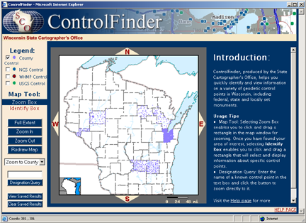
Figure 1: counties represented in ControlFinder
So far in 2004, six additional counties have expressed interest in making their control point information web-accessible through ControlFinder. Essentially, ControlFinder is a map-based search-and-query system for locating geodetic control points and then accessing useful information about those points.
Wisconsin Height Modernization Program (WI-HMP)
The Wisconsin Department of Transportation (WIDOT), with guidance from the National Geodetic Survey (NGS), continues its quest to improve the accuracy of the vertical component of the National Spatial Reference System (NSRS) through the WI-HMP.
The data collected on these monuments is submitted to NGS for bluebooking and then inserted into the NSRS database. After the completion of the phase (or region), the WIDOT work with the SCO to have these monuments represented and accessible using ControlFinder.
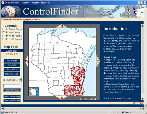
Figure 2: WI-HMP control representing four of the eight completed phases
For current details about the WI-HMP and status, refer to the article in this issue titled, Wisconsin’s Height Modernization Program moving ahead in high gear. We also have a section on our website on the WI-HMP that provides background and status of the program.
User interface upgraded
Meanwhile, we’ve improved the functionality of ControlFinder. Last month, we’ve uploaded a new interface that should make navigating more user friendly than our previous version (see Figure 3). Some enhancements include: boxes to turn on/off layers, ability to drag a box to zoom and to identify multiple points, ability to perform a search query on monument stampings, output results in a comma separated value (csv), etc.