
After an intensive year of planning meetings and community input, the Wisconsin Geographic Information Coordination Council (WIGICC) is finally a reality! The group met for the first time in Madison on September 23rd, and discussed where the council needs to go next in its early stages of development.
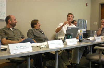
At the beginning of the inaugural WIGICC meeting, Ted Koch, State Cartographer, and Curtis Pulford, Geographic Information Officer, welcomed the new Council members and thanked them for their willingness to participate.
Harry Webne-Behrman, the professional facilitator who led last year’s listening sessions and summit meeting, kicked off the meeting with a question for the Council to consider as they embark on this process – how do we fully engage the geospatial community to determine a collaborative mode of leadership that is transparent, has integrity, and truly has value to those it represents? Council members then shared their perspectives on what they hope the Council will accomplish, and what each would like to contribute to the process.
Relationship of WIGICC to SCO and GIO
Commenting on the relationship of WIGICC to the Geographic Information Office (GIO) and State Cartographer’s Office (SCO), Pulford noted that WIGICC is advisory to his office. Both the SCO and GIO will provide coordination and support for WIGICC’s activities, including content development and maintenance for the WIGICC Web site.
Timeframe and formal establishment
Given the interim nature of the Council, Koch emphasized that the Council will need to be action-oriented, and will need to demonstrate its value to the geospatial community. Eighteen months from now, Koch noted, the Council will need to evaluate its structure and effectiveness, and make recommendations for the next incarnation of the Council. In the long-term, the Council also will need to consider options for its formal establishment, including executive order or legislation.
Guidelines and ground rules
The Council then addressed the guidelines and ground rules for its operation and for its interactions with the statewide stakeholder “Network.” Council members stressed the need to effectively communicate with the geospatial community. They advocated for democratic processes that incorporate and translate the wisdom of the Network into actionable recommendations.
Council members also underscored the need to have a clear vision and mission, and to have an action plan that is consistent with that mission. The Council decided that voting would be conducted through a roll call vote, with a simple majority of quorum being required to carry an action. Divergent opinions, the Council agreed, will be published in the meeting minutes along with the consensus decision. Notably, in order to give Council members and the stakeholder Network ample time to consider proposals and to provide feedback, proposed actions will require at least two weeks lead time before being brought to a vote. The Council wants to remain nimble, but also wants to ensure a democratic process.
Stakeholder Network meeting planned
In the second half of the day, the Council discussed the role of the statewide stakeholder Network, and its relationship to WIGICC. The statewide stakeholder Network will be a significant ingredient in WIGICC’s success.
The concept of the Network is still fairly fluid and will evolve over time. As currently envisioned, the Network will identify issues and make recommendations to the Council on actions and policies relating to the use and sharing of geographic information and data. It is open to all individuals and organizations with an interest in supporting the mission and goals of WIGICC. Ideally, the Network will involve those beyond traditional GIS communities, reaching into fields such as emergency management, economic development and education.
The Council charged the WIGICC working group with making the arrangements for the Network Kick-Off Meeting, scheduled for Tuesday, October 28th in Appleton at the Radisson Paper Valley Hotel.
At the first Network meeting, the Council will introduce the idea of “communities of practice,” which the Council hopes will form within the Network around common interests and within loosely defined geographic regions. To be successful, a community of practice brings together people with similar interests who form their own internal direction, character, and energy.These communities of practice will identify and discuss issues and bring forward recommendations to the Council that ultimately lead to better use, coordination, and success of geographic information and technology in Wisconsin.
Next steps
As the Council gets up and running, members decided that the Council should meet every two months. The agenda for the next meeting, to be scheduled before the end of this year, will include a debriefing on the listening sessions and summit from 2007, and on the Network meeting scheduled for October 28th. The Council also will be given a tour of the WIGICC Web site and the communication tools it provides, such as blogs and forums. The Council will need to elect its leadership, including a Chair, Vice-Chair, and Secretary, and to revise and ratify a draft charter and bylaws. Most importantly, the Council will need to identify two priority projects and chart its course for the coming year.