As I noted in a related Mapping Bulletin article published a few weeks ago, the Wisconsin Farm Service Agency office in Madison is beginning to receive some of the 2010 National Agriculture Imagery Program (NAIP) data acquired this past summer. So far, they have received 32 counties of imagery, mostly in southern Wisconsin.
If all goes well the hope is to have NAIP imagery for all 72 counties available for download from WisconsinView around the first of the year. Any delays in data coming from the USDA Aerial Photography Field Office will in turn delay the posting to WisconsinView, so the early January time frame is only an estimate at this point.
Initially, imagery available through WisconsinView will be in MrSID format, tiled as county mosaics, and projected to either UTM zone 15 or 16. Later, on a date yet to be determined, the same imagery will be available in GeoTIFF format, possibly along with a version projected to Wisconsin Transverse Mercator.
In the meantime, anyone with an immediate need can download the data through the USDA-NRCS Geospatial Data Gateway. At this time, only 12 counties in southern Wisconsin are available through the Data Gateway, but I suspect more will begin showing up quickly.
Images may require enhancement
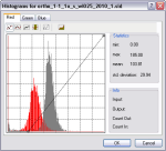
When I downloaded and viewed the first 2010 NAIP image of Dane County, I was honestly a bit surprised. The image looked very washed out, and most of the default image enhancements (e.g., standard deviation stretch, histogram equalization stretch) in ArcGIS 10 actually made matters much worse. [right click on the layer in the ArcGIS table of contents, select properties… symbology… stretch] I found that a “custom” stretch (on all three bands) that shifts the image histogram to the left (lower values) greatly improved the visual quality of the image. I had similar observations for the NAIP images covering Grant and Waukesha counties. The point being, don’t immediately reject what you see on the screen… it may take some tweaking.
I’m curious to know what your own experiences are with the 2010 NAIP imagery. Drop me a note anytime!

