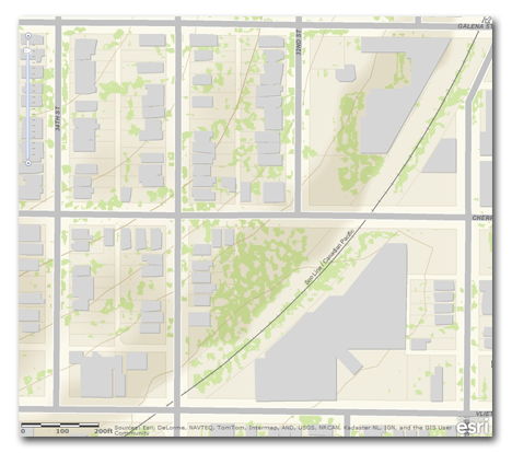
Esri’s Community Maps program is a way for local and state organizations to contribute and share authoritative geospatial data on the Web. This program is part of Esri’s growing suite of online resources, as discussed at the recent EWUG (Esri Wisconsin User Group) meeting in Green Bay on Nov. 9 and 10, 2011.
Through Esri’s program, data contributions from local and state organizations are integrated with other content, rendered using Esri cartographic design tools, and converted to map tiles in image format for Web-based delivery. These map tiles are essentially snapshots of the data at various scales; they are not editable vector data. Esri hosts the map tiles online as a map service, as part of a growing collection of community-built basemaps. The basemaps are viewable by Esri users within ArcGIS desktop, ArcGIS Explorer, ArcGIS Server, and ArcGIS.com.
Current Wisconsin contributors to the program include Milwaukee and Outagamie counties. Dane and Waukesha counties are also in the process of contributing, according to the program’s status map.
GIS coordinators in Milwaukee and Outagamie counties feel that the program is an effective way to deliver data to a broad audience. Bill Shaw, MCAMLIS Project Manager at the Milwaukee County Land Information Office, says that they “considered it a good opportunity to complete the circle of raw data to a more polished cartographic rendered product….Milwaukee has a huge investment in data but it is difficult to provide it in a consumable format. The Community Maps program provided an opportunity to meet this need and get exposure we might not otherwise have been able to.” Shaw sees one of the greatest potential applications of the program to be the ability to expose topographic and planimetric data, as a resource for local municipal operations.
Brad Bastian, GIS Coordinator and Land Information Officer in Outagamie County, says that one of the reasons they got involved was to begin to develop a cartographically appealing basemap that extended beyond the county boundary. “So many of our projects seem to extend into our neighboring counties, and we were relying on periodic data updates from them that had to be manipulated to get the same symbology as our data,” says Bastian.
In addition to streamlining this process, there have been other benefits to the county. For example, according to Bastian, the cartographic methods used to render basemaps for the program have been used in virtually every map they have produced since publishing their data. Bastian is encouraging neighboring counties to get involved to produce more consistent maps along county boundaries. He would also like to see statewide contributions at smaller map scales to support regional and multi-county mapping.
The basemaps distributed by Esri through this program are images, not editable vector data. Users can visualize the data but do not actually have access to the vector geometry or attributes, something that some local governments often feel the need to be cautious about. Partly for this reason, neither Milwaukee nor Outagamie counties encountered internal resistance to the idea of participating in the program. “We had no trouble introducing it to our Steering Committee,” says Shaw. “It clearly falls within three of our four strategic initiatives — public works, community outreach, and countywide initiatives.”
You can learn more about the Community Maps program on the program’s Web-site, which includes instructions on how to participate. Milwaukee and Outagamie county contributions can be visualized through Esri desktop and online applications. Choose the Topographic basemap and you will be able to see the local content at large scales as you zoom in to a small area.

Portion of Milwaukee County BaseMap
