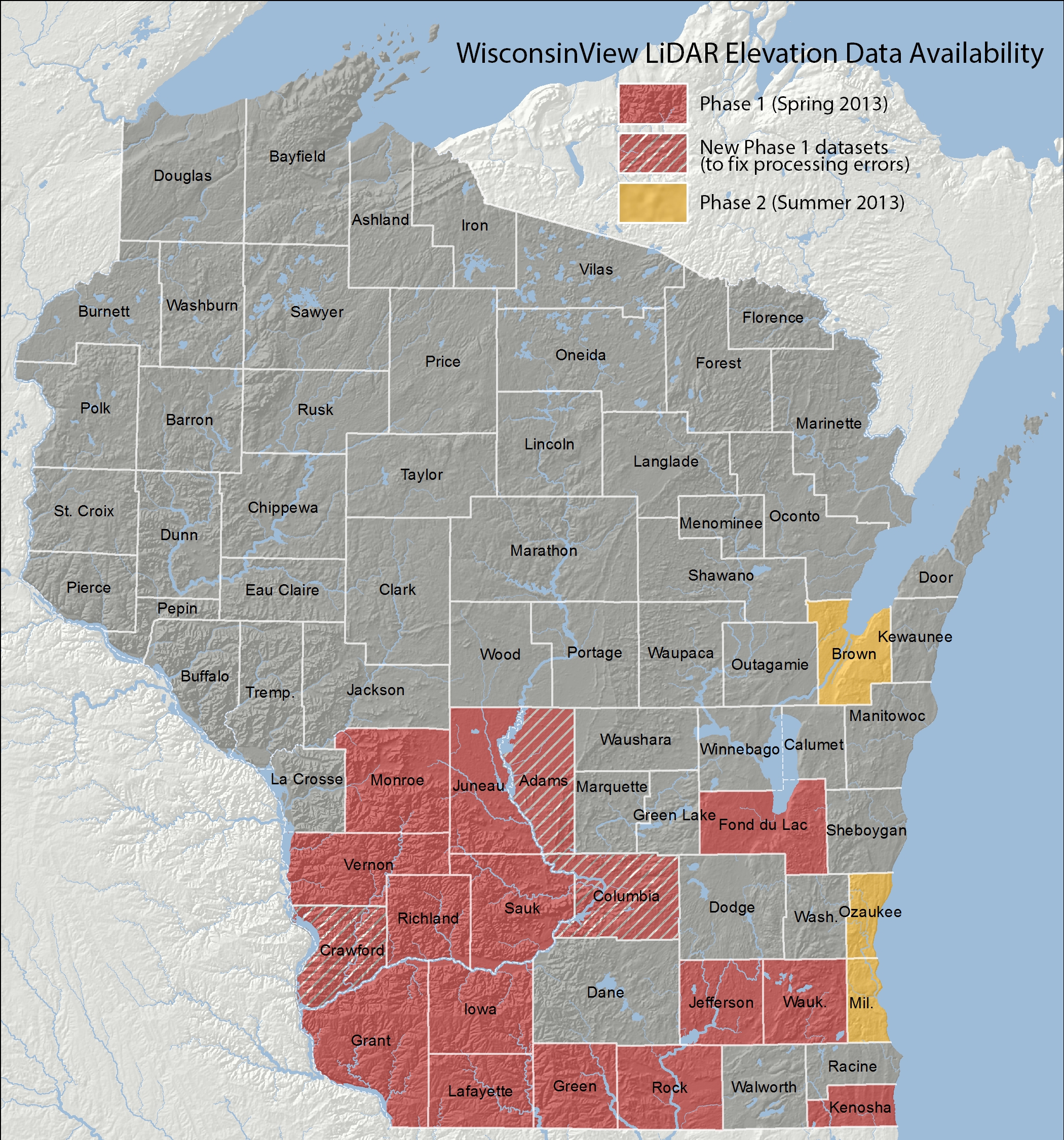
Three new counties have been added to WisconsinView’s collection of digital elevation models (DEMs) derived from LiDAR data.
DEMs for Brown, Milwaukee, and Ozaukee counties have been added. In addition, processing errors have been fixed and new DEMs have been loaded for Adams, Columbia, and Crawford counties.
There are now twenty county DEMs on WisconsinView: Adams, Brown, Columbia, Crawford, Fond du Lac, Grant, Green, Iowa, Jefferson, Juneau, Kenosha, Lafayette, Milwaukee, Monroe, Ozaukee, Richland, Rock, Sauk, Vernon and Waukesha.
All DEMs are available for download from the WisconsinView image downloads page.