Public access to LiDAR elevation data is becoming a reality in Wisconsin. Digital elevation models (DEMs) derived from LiDAR data are now available for some Wisconsin counties on WisconsinView.
Initially, WisconsinView will host data for many of the CDBG federal grant-funded counties in the southern part of the state. CDBG funding was provided to counties primarily affected by flooding in 2008. Additional counties will be added in future phases of the project.
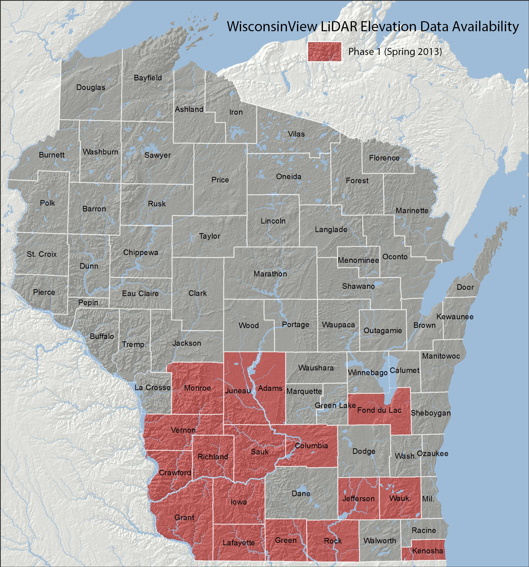
Counties included in phase 1 are: Adams, Columbia, Crawford, Fond du Lac, Grant, Green, Iowa, Jefferson, Juneau, Kenosha, Lafayette, Monroe, Richland, Rock, Sauk, Vernon and Waukesha.
The Wisconsin Department of Natural Resources (Floodplain Mapping) provided the data for phase 1 of the project. The DNR produces a standard, 5-foot resolution, hydro-flattened, bare-earth DEM from county LiDAR data. The DEMs on WisconsinView will eventually be in both ArcGRID and IMG formats; at present only ArcGRID format is available. Datasets are freely available and distribution is county-by-county.
WisconsinView already hosts a variety of aerial photography (such as WROC and NAIP) and is a logical fit for LiDAR data. The plan is to begin with derived elevation products (DEMs) and eventually serve all collected data.
At present DEMs are available for download from the WisconsinView image downloads page.
The LiDAR data initiative was led by team made up of individuals from WisconsinView, the Wisconsin Department of Natural Resources, Ayres Associates, the US Geological Survey, the State Cartographer’s Office, and the Wisconsin Geographic Information Coordination Council (WIGICC). In addition, the Land Information Officers Network (LION) assisted. The data initiative was recently noted in “LiDAR News,” a national LiDAR blog.
(Note: An earlier version of this article indicated that Adams, Columbia, and Crawford county were not yet available on WisconsinView. As of April 4, 2013, these counties have been added and are available for download.)