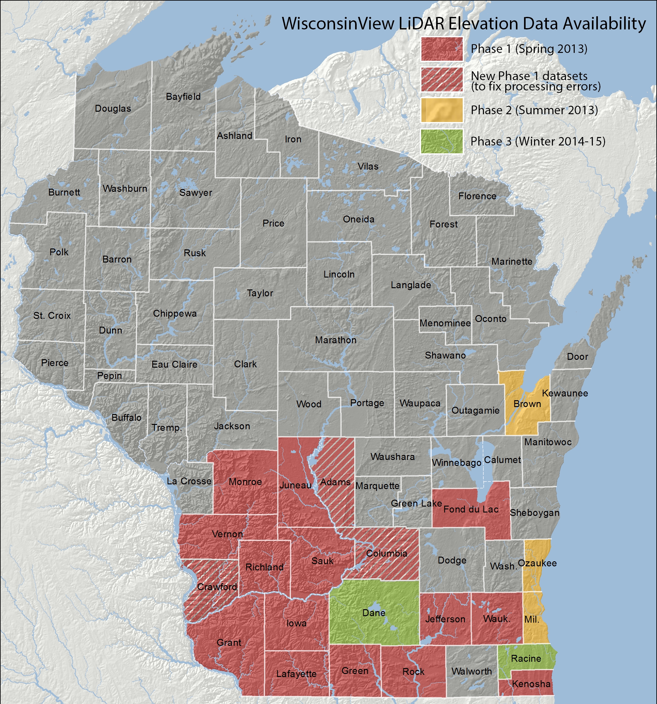
Two new counties — Dane and Racine — have been added to WisconsinView’s collection of digital elevation models (DEMs) derived from LiDAR data.
There are now twenty-two county DEMs in the collection: Adams, Brown, Columbia, Crawford, Dane, Fond du Lac, Grant, Green, Iowa, Jefferson, Juneau, Kenosha, Lafayette, Milwaukee, Monroe, Ozaukee, Racine, Richland, Rock, Sauk, Vernon, and Waukesha.
All DEMs are available free for download from the WisconsinView image downloads page.