
The UW-Madison Forest Landscape Ecology Lab (FLEL), the State Cartographer’s Office (SCO), and UW Digital Collections Center (UWDCC) are partnering on a new project to explore user needs for a digital map database of the Wisconsin landscape before EuroAmerican settlement.
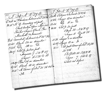 Page of field notes, T34N R29E (Door Co.), 1835.
Such notes have been transcribed, digitized, and
positioned geographically to create the FLEL database.
This database was developed by FLEL from the notes of General Land Office (GLO) surveyors between 1830 and 1865. (The notes themselves have been scanned by the UWDCC and are available online.) The GLO surveyors recorded the conditions of the landscape along their survey lines to create the Public Land Survey System (PLSS). The FLEL database includes information about the species and size of trees at every half-mile and one-mile corner in the state; observations about soils, vegetation, and ecosystems; and notes on features such as timber areas, ore outcroppings, and general suitability of the countryside. It includes notation of Indian gardens, villages, and trails, and any other cultural features encountered.
The goal of the project is to identify steps that can be taken to make the database more accessible and useful to interested citizens, community organizations, individual landowners, government agencies, and educators. While FLEL regularly shares the database upon request, the project collaborators envision making the historical information more available and accessible to a wider audience.
The project will involve a user needs analysis to better understand the user community and identify features they would find most useful. Over the summer and fall of 2015, a series of focus groups will be held throughout the state to elicit information from current and potential database users. At least one of these focus groups will include a webinar component. To augment the information learned from the focus groups, an online survey will also be developed. Proposed enhancements to the database, as identified by the user community, will then be evaluated to generate a set of final recommendations.
The project is funded by the Ira and Ineva Reilly Baldwin Wisconsin Idea Endowment, a competitive grant program designed to foster public engagement and advance the Wisconsin Idea – the principle that the University of Wisconsin should improve people’s lives beyond the classroom through teaching, research, outreach and public service.
Primary project participants include Prof. David Mladenoff (Director of FLEL), Dr. Howard Veregin (State Cartographer), and Peter Gorman (Head of UWDCC).
Information about the planned focus groups and online survey will be available within the next few months. Monitor the Wisconsin Mapping Bulletin for information. In the meantime, please share this information with anyone you think may have an interest in participating. We are especially eager to identify new and potential users of the database.