
There is still time to submit your abstract, but hurry, only a few spots remain open.
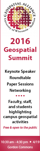
The Geospatial Summit, scheduled for Tuesday, April 19th from 10:30am – 4:30pm at Gordon Commons, is shaping up to be a great event with 15 concurrent paper sessions, a keynote address by Dr. Joseph Kerski, Esri, and a roundtable discussion on what types of workforce skills are on the horizon and how is higher education responding.
Registration is free and there is still time to submit your abstract.
The Geospatial Alliance website hosts the details, i.e., agenda, parking, directions, etc., about the Geospatial Summit located in the “Summit” tab across the top of the page.
10:30 – Noon
A special roundtable session will kick off the event bringing together academics and professionals to discuss, “What geospatial workforce skills are on the horizon and how is higher education responding?”
Panelists:
:: Joseph Kerski, Education Industry Curriculum Development Manager-Esri;
:: Janet Silbernagel, Professor and Director of the Environmental Conservation Professional Masters Program, Nelson Institute for Environmental Studies, UW-Madison;
:: Ian Muehlenhaus, Program Director, Online Masters in Cartography/GIS Development, Dept. of Geography, UW-Madison;
:: David Hart, President-Continental Mapping Consultants;
:: Emily Champagne, GIS Supervisor, Milwaukee Metropolitan Sewerage District;
:: John Czaplewski, Programmer/Analyst, Dept. of Geoscience, UW-Madison;
:: Lisa Morrison, GIS Section Chief/Acting Agency GIS Coordinator, Wisconsin Department of Natural Resources;
:: Fred Iausly, Dane County Land Information Office.
Noon – 1:00 pm Lunch (on your own)
1:00 pm – 3:00 pm Concurrent Paper Sessions (3); A total of fifteen (20-minute presentations) will be held concurrently in three rooms. Below are 11 of the 15 sessions as of today.
Professor Ian Muehlenhaus, Department of Geography
Professor Pang Fu, Division of Continuing Studies
Title: Lessons Learned: How to Navigate the Challenges of Establishing an Online Master’s Program in GIS
Professor Chuck DeMets, Department of Geoscience
Title: State-of-the-art GPS analysis for near-real-time research in continental deformation: Results for Wisconsin and the upper Midwest
Tanya Buckingham, Cartography Lab
Title: Run your own Design Challenge: the value of creating fast and big
Math Heinzel, Land Information & Computer Graphics Facility
Title: UW-Madison Campus ESRI License and resources
Professor David Gagnon, Wisconsin Institute for Discovery
Title: Field Work with Siftr: A free and open tool for lightweight locative data collection
Caitlin McKown, Dr. Bill Buckingham, Dr. Malia Jones, Applied Population Lab
Title: Adapting the 2SFCA to Model Spatial Accessibility of Primary Health Care in Wisconsin
Mitchell Johnson & AJ Wortley, State Cartographer’s Office
Title: Demographic Drive Time Analysis of Rural Hospitals in Wisconsin
Carl Sack, Dept. of Geography
Title: Teaching Open Source Web Mapping: An Instructional Design Approach
Professor Timothy Kennedy, UW-Stevens Point
Title: Unmanned Aerial Systems curriculum at UW-Stevens Point
Ben Zietlow, CFIRE – Civil & Environmental Engineering
Title: GIS’s Role in a USDOT National University Transportation Center
Jim Giglierano, Geographic Information Officer/Dept. of Administration
Title: TBA
3:00 pm – 3:30 pm Break (coffee/beverage)
3:30 pm – 4:30 pm Keynote by Dr. Joseph Kerski of Esri. Dr. Kerski is Esri’s Education Industry Curriculum Development Manager on the Education Team in Denver, CO. Tentatively his talk will be “Five Converging Trends: GIS&T on the World Stage.”
——————————————————————————————————————–
Questions?
Contact Brenda Hemstead at hemstead@wisc.edu or Howard Veregin at veregin@wisc.edu.