
Through the Wisconsin Land Information Program (WLIP), geospatial data from Wisconsin counties is collected each spring in support of statewide data integration, benchmarking and archiving. In 2017, counties submitted parcel and zoning data – now available through the Parcel Data Initiative project page – as well as address points, buildings, hydrography, land use, roads, right-of-ways, parks, recreation, and trails. All data submitted by counties are now available for public download on the GeoData@Wisconsin geoportal.
GeoData@Wisconsin
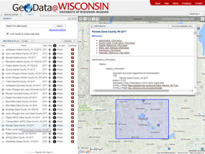
GeoData@Wisconsin is designed to provide single-source discovery and access to Wisconsin geospatial data, combining an intuitive map-based search interface with traditional text-based search capabilities (Fig. 1). While originally created to serve university researchers and students, with restricted access to many datasets as a result of county data licensing requiremements, GeoData@Wisconsin now contains hundreds of open datasets accessible by any user.
GeoData@Wisconsin was developed by the Robinson Map Library and the Wisconsin State Cartographer’s Office (SCO) at the University of Wisconsin-Madison. The Map Library and SCO maintain the geoportal using internal resources. Providing public access to geospatial data is an integral part of the mission of the Map Library and SCO, and aligns with the “Wisconsin Idea” linking the university to citizens’ lives throughout the state.
Wisconsin County Data
All 2017 data submitted by counties has been archived for long-term preservation at the Robinson Library. Publication datasets were created from the data by combining similar features into downloadable files. Including parcels and zoning, the 2017 data management process produced a total of 457 unique Wisconsin county datasets that are discoverable and available for public download on GeoData@Wisconsin.
All downloadable datasets are documented with complete metadata. Student assistants in the Library worked for five months (April-September, 2017) to write metadata for each dataset in both FGDC and ISO formats. Metadata is directly viewable in GeoData@Wisconsin so that users can find out more about the data before they download it.
County data for 2018 are currently being collected through the WLIP as part of the annual Parcel Data Initiative call for data. These datasets will also be processed by the Robinson Map Library for inclusion in GeoData@Wisconsin.
GeoData@Wisconsin Usage Statistics
In addition to county data collected annually, the Robinson Library acquires datasets from state agencies, municipalities, and regional planning commissions. All of these datasets are archived for long-term preservation. The geoportal also provides access to statewide orthoimagery and LiDAR DEMs from WisconsinView.
GeoData@Wisconsin currently has 905 public open-access datasets. The number of open datasets has been growing in recent years as counties have relaxed their data distribution restrictions and the WLIP has promulgated open data policies. GeoData@Wisconsin has 1241 restricted datasets – only available to UW researchers and students – for the years 2016 and earlier. All 2017 data are open-access.
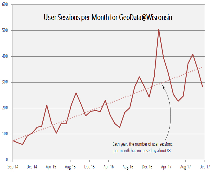
Use of GeoData@Wisconsin is growing steadily. Since the site’s inception in September 2014, it has generated over 30,000 pageviews in almost 8700 user sessions, and the number of user sessions per month is increasing at a rate of about 88 per year (Fig. 2).
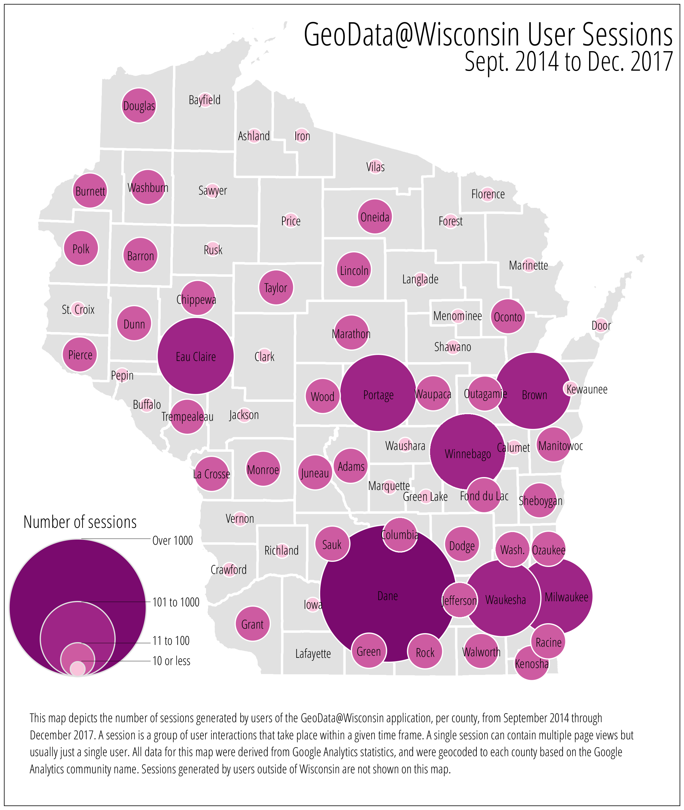
The geoportal is used throughout the state (and across the country) with the highest use rates occurring in the state’s largest counties (Fig. 3).
GeoData@Wisconsin can be accessed via the Robinson Map Library website or the State Cartographer’s Office website.
The direct link to the geoportal is maps.sco.wisc.edu/opengeoportal
Note: This article was written in collaboration with Jaime Martindale, Map and GIS Data Librarian at the Robinson Map Library in the Geography Department at UW-Madison.