
Do you need to know where you are in the Public Land Survey System (PLSS) network? If so, we have an app for you!
Our new PLSS Locator app lets you determine the township, range, section, quarter-section, and quarter-quarter-section for any location in Wisconsin. You can click directly on the map to identify the location you are interested in, or you can enter latitude-longitude coordinates, a street address, a county, or a city, village or town name.
At the SCO we often receive requests for PLSS location information from individuals investigating land ownership issues, filling out permits, or conducting research. The PLSS Locator app, developed by SCO staffer Hayden Elza, allows anyone to get this information easily whenever it is needed.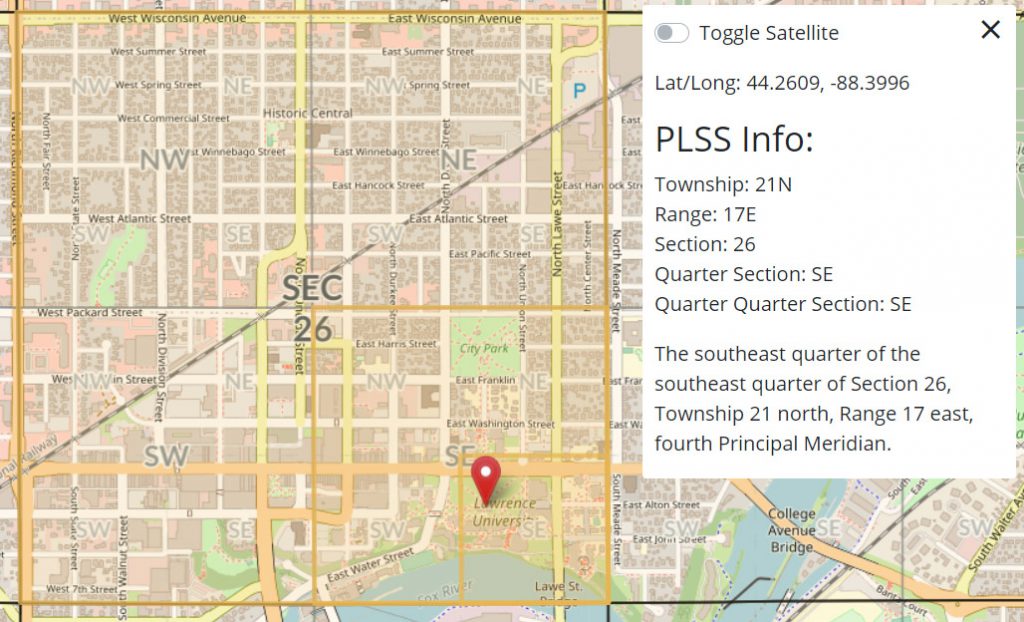
For readers unfamiliar with the PLSS network, more information can be found on our website here. PLSS is the foundation for property descriptions in Wisconsin and many other states. The system was set up by the federal government in the late 18th century as a way to partition federal lands and convey them to private ownership. In Wisconsin, PLSS surveys began in the 1830s and took several decades to complete. Surveyors literally walked thousands of miles, placing monuments at section and quarter section corners. The orderly pattern of townships, sections and quarter sections that covers most of Wisconsin — and many other Western states — is a direct result of PLSS surveying practices.
The SCO has a long history of working with PLSS data. For example, we are currently updating the statewide PLSS layer as part of the Statewide Parcel Initiative. The second edition of the PLSS layer in GIS format is expected to be completed by the end of 2020. In addition, we make information on county PLSS corner points available on our Survey Control Finder app.
So give our new PLSS Locator app a test drive and let us know what you think! If you have comments or questions please reach out to Hayden Elza.