
Do you have an interest in history? Did you ever wonder what Madison, Wisconsin, looked like a century ago? If so, click here to view an interactive photographic panorama of the city from the late 1890s taken from the Capitol dome (the second Capitol, not the current one).
The panorama is made from digital scans of original 8×10-inch glass negatives housed at the Library of Congress. Matt Noone at the Capital Area Regional Planning Commission stitched the individual images together to make the digital mosaic. The panorama extends from South Hamilton St. to East Washington Ave., a 225-degree swath that includes vistas along West Washington Ave., State St., Wisconsin Ave. and North Hamilton St. Buildings on the University of Wisconsin campus are clearly visible.
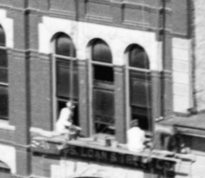
For a photograph from this era, the image is amazingly detailed, as you can see from the sample screenshot to the right.
Dating the photo precisely is difficult, but one clue is that the Wisconsin Historical Society building is incomplete. Construction of this building started in 1896 and the building opened in 1900, which puts this photograph somewhere between those two dates.
The digital image is large, containing almost 50,000 columns of pixels. To display such a large image online it has to be tiled in much the same way that basemaps are tiled for use in online mapping apps. The tiles are organized in a hierarchical structure so that as a user zooms in, more detailed tiles are loaded. In this example, the Google Maps API is used; image coordinates are effectively “fake” latitude-longitude values to allow the API to function as if it were serving up a real map.
The image also contains over fifty clickable links (the small eye icons) that take the user to a current Google Maps Street View image showing how the location looks today.
Madison has changed a lot since the 1890s and many significant buildings have unfortunately been lost. This image is one way to see these buildings in context and try to imagine how the city looked over 120 years ago.
Note that this app has been minimally tested, so if you see anything strange or experience problems, please let me know!
More Information
Information and digital scans of the original images are available here:
Detroit Publishing Company. Panorama from Capitol Dome. Dated between 1880 and 1899. Library of Congress Call Number LC-D4-10050 [P&P] LC-D4-4634 LC-D4-4635 LC-D4-4636.
If you are interested in exploring Madison’s history in more detail here are some good resources:
Feldman, J., 1997. The Buildings of the University of Wisconsin. The University Archives.
Johnson, D.J., 2007. Historic Photos of Madison. Turner Publishing.
Levitan, S.D., 2006. Madison: The Illustrated Sesquicentennial History. University of Wisconsin Press.
Mollenhoff, D.V., 2003. Madison, a History of the Formative Years. University of Wisconsin Press.
Wisconsin Historical Society. Digitized Sanborn Fire Insurance Maps. Various dates.