Staff from State Cartographer’s Office delivered a total of four presentations at the recent Wisconsin Land Information Association Annual Conference, held February 23-25 2022 in Elkhart Lake, WI. Below you can find summaries of our presentations along with links to slides. Please feel free to contact us, or reach out directly to the listed presenters if you would like any additional information!
PDF Maps: From Static to Interactive to “Wait, I Didn’t Know PDFs Could Do That!”
Hayden Elza
You’ve probably used PDF maps before and you’ve probably even heard of a GeoPDF, but did you know that PDFs can have javascript? In this talk I explore PDF maps from the simple interactive map exported from QGIS or GDAL to a more complicated example the pushes the limits of what can be achieved in PDFs.
Wisconsin Spatial Reference Systems 2022 Task Force Update
Howard Veregin and Dick Kleinmann (Ayres Associates)
In 2022 the National Geodetic Survey (NGS) will replace NAD 83 and NAVD 88 with new horizontal and vertical reference systems known as the North American Terrestrial Reference Frame of 2022 (NATRF2022) and the North American-Pacific Geopotential Datum of 2022 (NAPGD2022). These changes will have significant effects on surveying, mapping and GIS across Wisconsin. To respond to these changes, the Wisconsin Spatial Reference System 2022 Task Force (WSRS 2022) has been organized under the Wisconsin Society of Land Surveyors (WSLS). Howard and Richard provided an update on what GIS, mapping, and surveying professionals should understand about these forthcoming changes.
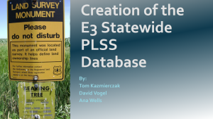
Creation of the E3 Statewide Public Land Survey System Database
Tom Kazmierczak, David Vogel, and Ana Wells
In November of 2021, the State Cartographer’s Office and WLIP released the 3rd version of the Statewide PLSS database, a subproject of the greater Statewide Parcel Map Initiative. The E3 database relies on county coordinate data whenever possible, allowing for spatial improvements over previous statewide PLSS layers. Our talk focuses on the characteristics of the database and the technical aspects of its creation.
Wisconsin Coastal-Data Infrastructure Winter 2022 Update
Genevieve Burgess and Melanie Kohls (formerly with the SCO)
The Wisconsin Coastal-Management Data Infrastructure project continues to build on its goals of increasing tools, training, and data geared toward culvert mapping in the Lake Superior region and beyond. Recent updates include development of culvert collection tools, a culvert database web app, and community expansion to the Lake Michigan coast. Our presentation describes these updates (and more), and how you may want to get involved with WICDI as we continue to grow.


