
It’s been a year since we released our Hidden Communities app. This app documents a variety of communities in the state that do not appear on maps, or conversely, appear on maps when they shouldn’t. Some are small unincorporated communities, others are historic railroad junctions, mining towns or other places that once existed but have now disappeared.
Over the past year, we’ve been working to incorporate research done by the public. We received feedback from almost a dozen people resulting in edits to over forty hidden communities in the app. A few examples are:
- Exile (Pierce County) – A ghost town that once had a post office, sawmills, a blacksmith shop and a general store. (Research by M. Nelson)
- Malvern (Oneida County) – A forgotten ghost town that sprang up after the cutover period. (Research by S. Reich)
- North Tomah (Monroe County) – A community we added to the app. (Research by J. Erickson)
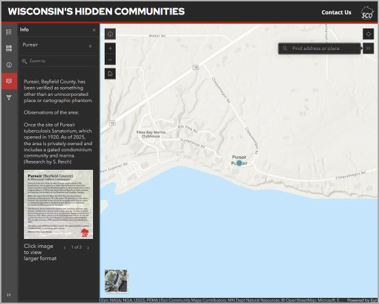
- Pureair (Bayfield County) – The site of the former Pureair Tuberculosis Sanatorium, which opened in 1920. (Research by S. Reich)
- Rib Mountain (Marathon County) – Now an incorporated village and no longer and unincorporated community. (Research by A. Bohn and B. Lazar)
- Ulao (Ozaukee County) – Once a small port on the coast of Lake Michigan. Ulao is also known as the home of Charles Guiteau, who assassinated President James Garfield in 1881. (Research By B, Lazar)
Space prevents us from listing all the edits we made, but thanks to everyone who submitted comments and conducted research. Keep them coming!
For these and other hidden communities, we have also included in-depth histories based on the research done by our contributors, to give more nuance about what the community is, or was.
Another change we made to the app is to include a new category of hidden communities, to help differentiate between places that are unverified or haven’t been visited, and places that don’t fall into other map categories. The app now shows:
- Unincorporated communities – Places that still exist, have a name, but are not legally incorporated.
- Cartographic phantoms – Appear on maps, but there’s nothing on the ground to suggest they still exist or possibly ever existed.
- Unverified locales – Places that need more research. They might be unincorporated communities, cartographic phantoms, or something in between.
- Other places – Something other than an unincorporated community or cartographic phantom, including city neighborhoods, mobile home parks, resorts, industrial sites, etc.
We are working to acquire more information on unverified locales to fill in the map.
We hope you’ll take a few minutes to explore the app and learn more about the hidden, and sometimes surprising, history of communities across the state.