
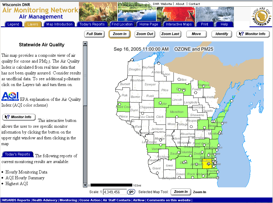
People interested in learning more about the quality of the air where they live in Wisconsin can take advantage of an improved interactive Internet mapping application through the Department of Natural Resources website. The revised air monitoring site takes advantage of the DNR’s Geographic Information Systems capabilities that make current and past air quality data more accessible.
“The maps on these pages are interactive and show a composite view of air quality in Wisconsin for ozone and particle pollution using the color coded Air Quality Index,” says Lloyd Eagan, director of the DNR Bureau of Air Management. “The statewide map shows the locations of DNR monitors and the real-time Air Quality Index for the county in which the monitor is located.”
Source: Wisconsin Department of Natural Resources