
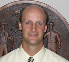
David Mockert, a Sheboygan native and UW-Madison graduate, joined the Wisconsin Department of Administration in September 2005 as the state Geographic Information Officer. Dave and I recently sat down to talk about his new job, and his thoughts for the future.
First, welcome back to Wisconsin! Can you tell me a little bit about your background, and your most recent positions with the City of Indianapolis/Marion County?
Thanks, it’s great to be back. I’m truly excited about my new position, and look forward to working with the GIS community in Wisconsin. As for my background, I’ve had the opportunity to work both in the private sector and in local government. My GIS career started with the Convergent Group out of Denver, Colorado in 1995. While working for Convergent, I spent a lot of time traveling around the country helping government agencies plan large-scale GIS implementations.
One of my main clients was the City of Indianapolis and Marion County, Indiana. I frequently commuted back and forth between Denver and Indianapolis to help them move their GIS program forward. Finally, in 1998 they asked me if I would consider coming on board full-time as their GIS Administrator. For the next five years it was my job to lead all the GIS activities for the city/county.
More recently, in 2004, I moved up to serve as their Chief Information Officer. This was a very challenging, politically charged position, but I learned a lot about how politics work in government organizations. I was in that role for 18 months before coming to Wisconsin.
What led to your interest in the GIO position?
I’m very passionate about GIS, and I wanted to get back into it; GIS was something I didn’t get to focus on as a CIO. I viewed the Wisconsin GIO job as an opportunity to take on an important leadership position in state government. When I met with [Department of Administration Chief Information Officer] Matt Miszewski and his management team, I was very impressed with their professionalism and vision for enterprise technology in the state. Not long into the conversation, I knew that I wanted to be part of that vision.
You work for the Division of Enterprise Technology at DOA, and report to the Chief Information Officer. What are your feelings on the relationship between GIS and the broader world of Information Technology?
When I arrived in Indianapolis, one of my first challenges was to better integrate GIS services into the activities of our IT department. Previously, they were two separate shops that didn’t work together as much as they should. To answer your question directly, I think it’s critical to build strong ties between “traditional” IT and GIS. It just makes sense to have the IT staff worrying about enterprise databases, server management, and so on, so the GIS specialists can focus on analysis, developing quality data, and helping end-users solve problems.
I won’t kid you, building a tighter integration between IT and GIS was challenging in Indianapolis. We spent a lot of time educating database and server administrators about GIS! Another of our major hurdles was coming to grips with the fact that GIS users need more help and handholding than the typical IT helpdesk model could provide. Unfortunately, like most government organizations, we didn’t have the staff to support the demand for our services. One thing we did to address this situation was put a strong emphasis on training so GIS users could be more self-sufficient. In doing so, our GIS staff could focus on mentoring, rather than trying to do it all themselves.
What are your short-term priorities?
My job is to carry out the Governor’s vision for efficient and effective government. With that as my starting point, my initial focus will be on addressing a variety of state government issues.
Specifically, some of our large agencies like DOT and DNR have great GIS programs that started in the mid-80’s, but many other agencies have struggled to develop their own capabilities in recent years. I believe we’re at a critical crossroads where we need to do better a job sharing technical resources. We also need to break down the “silos,” and think beyond agency-specific needs when we implement new tools or technology.
We also have a lot of policy and organizational issues to sort out at the state level. Data sharing between state agencies continues to be problematic, and we have very few standards that cut across agency boundaries. The people doing GIS have known this for years, so the challenge is educating agency heads so they understand why this is so problematic.
We also need to work on our relationship with local governments. It’s unfortunate that counties are frequently contacted by multiple agencies asking for the same data; it looks bad for the agencies, it’s inefficient for everyone involved, and it puts additional burden on local governments that are already strapped for resources.
Thinking toward the future, as we get things into better shape within state government, I want to work more directly with the locals. As I see it, everything we do at the state should ultimately support the counties in their own efforts. For example, I’m very interested in helping coordinate a statewide digital orthophoto acquisition project.
With the elimination of the Wisconsin Land Information Board last July, Wisconsin lacks a coordinating body for GIS. What are your thoughts on establishing a statewide GIS council?
As I see it, one important role of a coordinating council is to develop a truly statewide, not just state agency, vision for GIS in Wisconsin. A council is a great way to keep the lines of communication open between all levels of government, and it’s a concept I support.
A concern I have is that many statewide councils tend to have memberships that are geographically biased toward the capital city. From a practical standpoint, this is understandable. To address this situation, we need groups like the Land Information Officers network represented on the council, along with strong regional champions to step up and promote GIS in their respective regions. I’ve already seen great leadership from Regional Planning Commissions in this regard, and I hope to see more in the future.
Over the past few months on the job, you’ve had the opportunity to meet a lot of people, and get a feel for how things work in Wisconsin. What are your observations so far?
Without question, there is an amazing range of GIS-related activity happening in Wisconsin. We have a great network of people with diverse talents, and a well-established base of private sector consultants working with all levels of government. The funding model of the Wisconsin Land Information Program is envied by many states throughout the nation.
However, in state government specifically, we haven’t had a strong leader to coordinate issues that cut across agency boundaries. Simply put, we haven’t had a champion for the cause. I also think we lack a statewide vision for geospatial technologies, and a strategic plan to support that vision.
Sure, we have plenty of challenges to address. But I feel good about what I’ve seen so far, and look forward to working with everyone around the state to make Wisconsin a national leader in GIS.
Please join me in welcoming Dave back to Wisconsin. He can be reached via e-mail at david.mockert@wisconsin.gov, or by phone at (608) 261-5042.