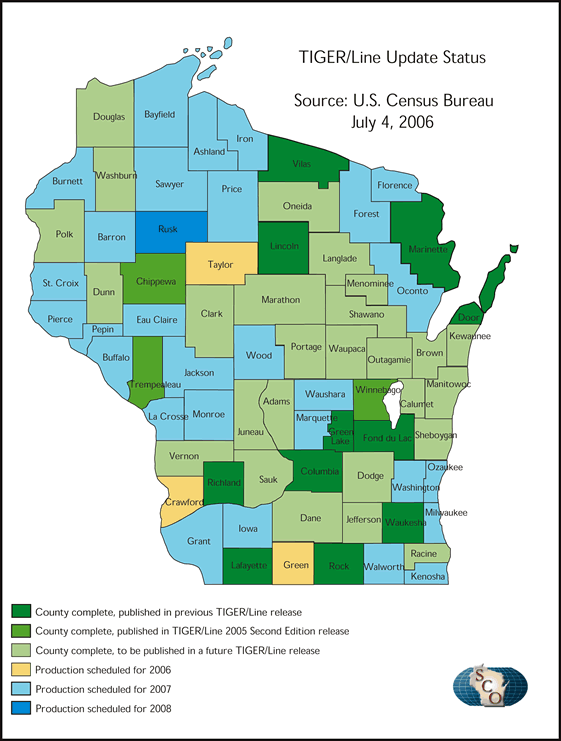
The U.S. Census Bureau recently announced the availability of their 2005 “Second Edition” Topologically Integrated Geographic Encoding and Referencing (TIGER)/Line files. This latest update is part of their ongoing project to improve the quality and spatial accuracy of the TIGER/Line dataset for the 2010 census. Spatial data for 14 Wisconsin counties have been updated thus far, with another 21 counties expected as part of a yet-to-be-determined future release of TIGER/Line.
As Ted Koch outlined in his December 2004 Mapping Bulletin article, the U.S. Census Bureau is actively seeking out locally-created street centerlines, and where possible, using these data to spatially adjust, or “re-align” existing TIGER files to improve their accuracy. In cases where no local data are available, or where the local data does not meet the Census Bureau basic positional accuracy requirement, a contractor updates and adjusts the TIGER/Line files by either driving the roadways with a GPS system, or using orthoimagery and heads-up digitizing.
The goal is to have the national realignment complete by the end of 2008. Another long-term goal, according to Gail Krmenec, Geographer with the U.S. Census Bureau regional office in Chicago, is to move away from the current TIGER/Line file structure toward a Geographic Markup Language-based encoding for data exchange called TIGER/GML. This approach will better facilitate feature data exchange using a widely-accepted international standard.