
ControlFinder is a free, easy-to-use, online catalog of approximately 25,000 control points in Wisconsin. It provides access to control established by a variety of organizations, including the National Geodetic Survey, the U.S. Geological Survey (historical 3rd order vertical), the Wisconsin Department of Transportation Height Modernization Program, and local control established by various Wisconsin counties.
Control points are shown on a statewide map, and linked to a database containing information such as the control point name, map coordinates, height, metadata, and other pertinent characteristics for that point. Whenever possible, control point records are linked to additional or more detailed information on the websites of contributing agencies.
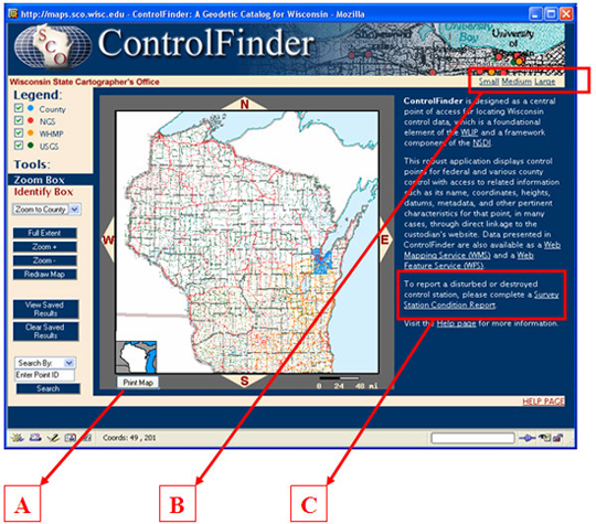
New Features
In the past months, new features have been added to ControlFinder, including:
A. Ability to print (pdf) the map display view regardless of zoom level;
B. Ability to resize the application window as small, medium, or large;
C. Ability to file online station condition reports.
We continue to evolve and improve ControlFinder while adhering to emerging interoperable standards for digital data content and online delivery methods. Over the long haul, we believe following a standards-based approach will make information useable by the widest possible audience.
For comments, questions, or to contribute geodetic data, please contact Brenda Hemstead at (608) 263-4371.