
In late September, Madison was the site of the first Great Lakes Regional Height Modernization Forum. Hosted by the Wisconsin Department of Transportation (WisDOT), in conjunction with the NOAA National Geodetic Survey (NGS), the Great Lakes Forum brought together federal, state, local, and private-sector representatives to discuss the NGS program to improve elevation data throughout the region.
About “Height Mod”
NGS’s Height Modernization Program (HMP) is a nationwide program that supports the establishment of more accurate, more reliable elevations using Global Positioning System (GPS) technology, along with traditional leveling to bench marks, improved gravity models, and the latest in remote sensing information. The HMP is being implemented to address the needs for increased accuracy of elevation data required for a variety of applications ranging from floodplain mapping and emergency preparedness to precision agriculture. Based on pilot efforts with a number of state partners over the past several years, NGS is now proposing to make the HMP a national program by taking it to every state in the nation.
NGS supports the HMP through a program of competitive grants, technical support, education, and technology transfer. In an effort to improve the efficiency of the program, and to help share information about common challenges and solutions for improving elevation information, NGS is organizing the states by regions. The states of Ohio, Indiana, Illinois, Michigan, Wisconsin, and Minnesota are currently part of the Great Lakes HMP Region. New York, Pennsylvania, and Iowa may be added to the region in the future.
Forum looks at regional issues
Because of WisDOT’s past leadership in improving both the horizontal and vertical geodetic networks in the state, they have been designated by NGS to provide leadership for the Great Lakes region. The Forum held in Madison in late September is one of the major steps WisDOT is taking to provide this leadership and assist other states in the Great Lakes region as these states move to become full partners with NGS in the HMP.
The first day of the Forum in Madison had an educational theme, devoted to presentations on:
- The National HMP – how NGS, at the direction of Congress, is developing ways to cost-effectively improve elevation information across the country, the history and evolution of the HMP, and the state and regional partnerships that are now being put in place between NGS and states.
- The GRAV-D Program – because gravity is a key component in the determination of accurate elevations, NGS developed a plan to improve both the quality and quantity of gravity data through a program called GRAV-D. The discussion outlined the plan for GRAV-D, described the goals, expectations, and costs of the program, and discussed how it will benefit, compliment, and strengthen other components of the HMP.
- The International Great Lakes Datum (IGLD) – NOAA staff reported on the 54 active lake level stations that provide information critical to nautical charts, shipping, values of lake front property, and power generation, and how more accurate elevation information will benefit the IGLD program.
- State Benefits from Improved Elevations – North Carolina reported on the applications and benefits they have realized as a result of their participation in the HMP over the past 10 years, including availability of statewide LiDAR data, improved floodplain information rate maps (FIRMs), more accurate property assessment, support for their dam safety program, and a modern flood warning system. The state program that cost $100 million is providing on-going benefits of at least $55 million annually.
- Regional HMP Plan – The NOAA/NGS plan for the HMP on a regional basis was described and discussed, including objectives, structure, governance, membership and likely activities.
- Status of HMP in Other Regions – Given the strength of the regional approach, as well as to be aware of significant differences among regions, NGS partners from the Gulf of Mexico region described progress, problems, and issues they have encountered in their regional HMP efforts along the Gulf coast.
- NOAA Grants for Support of the HMP – Several states have received HMP grants from NOAA over the past several years to support their work. One session at the forum was devoted to a discussion of the NOAA grants program, currently operating as a competitive process. Topics ranged from notice of availability in the Federal Register through the multi-step application process, negotiation, final award and subsequent reporting requirements.
Individual State Activities
In the afternoon of day one, representatives of the six Great Lakes states were given an opportunity to share the status of activities in their state. States reported on history and status of geodetic surveying in their state, plans for the next five years, current support for the HMP in terms of staffing and cost sharing, and reaction to the regional approach NOAA/NGS is implementing to support the HMP. Among the items noted in these state presentations:
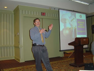
Andy Semenchuck from the Michigan DOT.
- Four states (Michigan, Minnesota, Ohio, and Wisconsin) are well along in developing statewide CORS (Continuously Operating Reference Station) networks.
- Some states charge user fees for access to their CORS network, in other states network sponsoring agencies provide this as a free service.
- Classical/conventional leveling is still a major requirement, and one of the most costly aspects of the HMP for states.
- Partnerships are a crucial component for success of the HMP in most states.
- NGS support is vital for continued progress of state HMP activities.
- States have relied on 1998 NGS study for Congress to provide justification of need and value of HMP (e.g., use of more accurate elevations for floodplain mapping, precision agriculture and wetlands restoration).
- A large proportion of state-funded leveling is being done by contractors, due to reduction in technically trained staff numbers in responsible state agencies.
The remainder of the forum was devoted to general discussions on the content of educational presentations made at the forum, as well as how to organize the group and possible components of an action plan to facilitate the HMP in the Great Lakes region. Work by individual members on specific action items is currently underway, with a second face-to-face forum planned for early next spring in Michigan.
Individual presentations from the Forum are available through links embedded in a PDF document on the NGS Web site.