
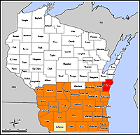
In recent weeks, County Land Information Officers in 31 eligible counties learned of a new grant opportunity that could fund a significant amount of LiDAR in southern Wisconsin next year.
The Wisconsin Department of Commerce, working in conjunction with the Department of Natural Resources, is making a yet-to-be-determined amount of funds available for up to 31 counties affected by the devastating flooding that occured in Wisconsin in 2008. Eligibility for the program was determined by the 2008 federal disaster declarations for severe storms, tornadoes, and flooding.
The funds are available through the WI Department of Commerce Community Development Block Grant – Emergency Assistance Program (CDBG-EAP). Many counties already have existing CDBG contracts in place, so the LiDAR acquisition grant was an add-on to the existing program.
The eventual intent is to use the LiDAR data to increase the accuracy of floodplain maps by better representing topography along stream and river corridors. While the opportunity for more LiDAR is very good news, ongoing updates to floodplain maps will be highly dependent upon continued federal funding from the Federal Emergency Management Agency (FEMA) “RiskMap” program.
Data funded under the CDBG-EAP program must meet FEMA standards for floodplain mapping. This includes bare-earth points and breaklines certified to a vertical accuracy of 1.2 feet at a 95% confidence level, and a 19-foot horizontal accuracy at a 95% confidence level. FGDC compliant metadata and an NSSDA accuracy report are also required.
At this time, it is unknown when the LiDAR grant awards will be announced, how much total funding will be awarded, or when the funds will be available to grant recipients. Additional status updates on this grant program should be known in early 2010.
USGS stimulus grant program also in the mix
In addition to the CDBG-EAP grant program, the application period closed on December 1 for another stimulus-driven program, this one managed by the U.S. Geological Survey. As part of the American Recovery and Reinvestment Act, the USGS was authorized to spend up to $15 million nationally for LiDAR and orthoimagery acquisitions. $8.775 million of that total is being made available to state and local governments under a competitive grant program.
The National Map: Imagery and Elevation Maps under ARRA” program will provide between $50,000 and $500,000 to successful projects. Data acquired will made available to the USGS for inclusion in The National Map. Priorities for the program include elevation data over coastal areas of United States most susceptible to storm and hurricane flooding, earthquake damage, and coastal erosion. Coastal areas of the Great Lakes fit this definition, but at this point, nobody knows the relative priority of the Great Lakes compared to other coastal areas. Increasing the coverage and availability of leaf-off, high resolution orthoimagery is another goal of the program.
At this time, it appears only a small handful of counties in Wisconsin applied for the USGS stimulus funds. Decisions on the grant applications should be made early in the first quarter of 2010.