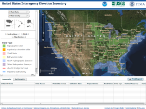
A new online elevation inventory tool was unveiled last week by the U.S Geological Survey (USGS), National Oceanic and Atmospheric Administration (NOAA), and the Federal Emergency Management Agency (FEMA). The U.S. Interagency Elevation Inventory (USIEI) displays high-accuracy topographic and bathymetric data for the United States and its territories, and is intended to serve as a comprehensive, nationwide listing of known high-accuracy topographic data, including LiDAR and IfSAR, and bathymetric data, including NOAA hydrographic surveys, multibeam data, and bathymetric LiDAR.
The joint venture merges at least two previously-independent efforts. The NOAA Coastal Services center has been tracking coastal elevation and bathymetric data through their Digital Coast initiative, and the USGS wrapped up their National Enhanced Elevation Assessment in late 2011. Future elevation inventory efforts will be cooperatively managed under the umbrella of the new Interagency Elevation Inventory.
Anyone interested in learning more is invited to watch a 30 minute recorded Webinar on the “New Elevation Inventory for the Nation.”
Source: NOAA

