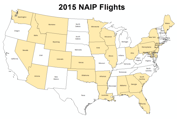
Imagery acquisitions for the 2015 National Agriculture Imagery Program (NAIP) are scheduled to begin in Wisconsin around June 20th and run through the end of August. Administered by the USDA Farm Service Agency (FSA) through the Aerial Photography Field Office in Salt Lake City, the program acquires aerial imagery during the agricultural growing seasons in the continental United States. Wisconsin was last flown during the summer of 2013.
The 2015 NAIP imagery delivered to the APFO by their contractors (Northwest Geomatics, Surdex, and Quantum Spatial) will have a 1-meter spatial resolution, and include four spectral bands: RGB and near-infrared. Surdex was awarded the contract for Wisconsin.
Imagery is delivered to APFO from the contractors within 30 days after the end of the flying season, and then Compressed County Mosaics (CCMs) are made available as a free download from the Natural Resources Conservation Service (NRCS) Geospatial Data Gateway. As in the past, I expect the original GeoTIFF tiles will be available via the WisconsinView data portal, but as of this writing, no specific plans have been made.
We’ll continue to update you on the 2015 program as more details become available. In the meantime, be sure to check out the APFO NAIP status viewer and watch the progress of flights over the summer.