
The State Cartographer’s Office (SCO) hosted a one-day forum entitled, “Parcel Mapping and the Public Land Survey in Wisconsin” at UW Eau Claire on March 15, 2016. The Forum was made possible by a Statewide Outreach Incentive Grant from the UW-Madison Office of University Relations, and a matching grant from the UW Eau Claire Department of Geography and Anthropology. The Forum was free to all attendees. A final report on the Forum is now available online.
Purpose of the Forum
The purpose of the Forum was to foster community-wide dialog about county surveying and tax parcel mapping activities in Wisconsin. The 2016 Forum was the sequel to a similar Forum in 2015, also funded through a Statewide Outreach Grant. The 2016 Forum brought stakeholders together to discuss how to improve parcel mapping methods and better utilize the Public Land Survey System (PLSS) to improve parcel map accuracy and facilitate data integration.
Different viewpoints exist within the community about how to coordinate surveying and parcel mapping efforts, and what activities should be prioritized. On the one hand, there is a clear business need and statutory mandate for a statewide parcel map. On the other hand, any parcel map created without a base of up-to-date PLSS data will ultimately need to be readjusted once the PLSS network is complete.
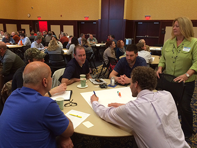
The forum was attended by county surveyors responsible for the PLSS network, GIS and land information professionals responsible for tax parcel mapping, students, and members of the broader geospatial community representing a cross-section of users. Attendance was approximately 90 people.
Core Themes
The Forum included short presentations followed by group discussion. Discussion focused on the following questions:
- How accurate do parcel maps need to be and what aspects of accuracy are most important?
- How does the PLSS help improve accuracy?
- How can we balance the needs for positional accuracy against users’ needs for a complete statewide parcel map?
- What strategies will ensure that PLSS will be prioritized and completed?
- What is the most important step we can take to improve parcel map accuracy?
Many themes run through attendees’ responses to these questions. Some of the core themes are listed below.
- We need to complete the PLSS and use this data to improve the parcel map.
- Maps need to be accurate because users make important decisions based on them, but the importance of accuracy depends on the use and purpose of the map and the needs of the user.
- Education about PLSS and parcel maps is critically important. Users need to be educated about the limitations of parcel maps.
- We need to educate decision-makers about parcel mapping and PLSS. Once people understand the importance of PLSS and parcels, there will be more support and funding for projects.
- Adequate education of parcel mapping technicians is also necessary.
- More coordination is needed. We should keep communicating and collaborating, and bringing people together with similar goals.
- County boundaries should match, with no gaps or overlaps. We need to work together to solve this problem.
- Completion of PLSS will require funding.
- County surveyor positions need to be supported.
- We need to set and follow goals, strategies, and priorities that include PLSS. The plan also needs to include statewide standards to ensure mapping consistency and efficiency.
- We must rely on local knowledge, so that we can offer flexibility to counties to complete the process in their own way.
While all of these ideas were expressed by multiple participants, some were seen as more critical than others. For more information, including a listing of the actual responses to discussion questions, please see the final report.
Next Steps
One concrete step resulting from the Forum is the creation of a “PLSS Work Group” to craft a position statement on PLSS and parcel mapping. This position statement will provide a consistent message that can be delivered to county officials and other decision-makers about the importance and value of PLSS and parcel mapping. The work group contains representatives from the Wisconsin County Surveyors Association, Wisconsin Society of Land Surveyors, Wisconsin Land Information Association, Land Information Officers Network, and the South West Wisconsin Regional Planning Commission. The effort is being coordinated by the SCO.
We are interested in your thoughts and ideas, and your suggestions for the PLSS Work Group. If you have any comments please contact us!
Howard Veregin 608-262-6852
Brenda Hemstead 608-263-4371