Quick Links
- Bulk downloads in GeoData@Wisconsin
- How to connect to the imagery and lidar archive with a S3 browser
- Search for data with the GeoData@Wisconsin geoportal
Many of you reading this already know about the GeoData@Wisconsin geoportal and using it to find and download Wisconsin aerial imagery and lidar data, as well as many other types of Wisconsin geospatial data. But did you know you download gigabytes of imagery and lidar data without repeatedly clicking on an index map?
All of the imagery and lidar data available through GeoData@Wisconsin are held in what is called an S3 “bucket.” If you know where to look, you can connect directly to the WisconsinView Data Archive S3 bucket and skip the web interface. This can come in handy when you need to download many hundreds of files, which is common when working with tiled lidar data. We refer to this process as “bulk downloading” from the archive.
Some Assembly Required
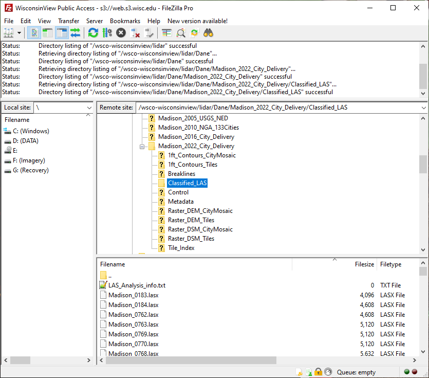
Connecting to an S3 bucket for bulk downloads is best accomplished using a desktop tool installed on your computer. Cyberduck is a popular free choice, while FileZilla Pro is a great option if you are able to spend $13.00 on the purchase price. Note: the free version of FileZilla does NOT support the S3 protocol needed to make the connection. We have a complete set of instructions available if you want to give Cyberduck a try. The same principles and parameters apply in FileZilla Pro.
Although it’s not quite as user-friendly, we also developed a Python 3.x script that can be used to download data from the archive. This is a good option if you like a scripted approach, or your IT department won’t let you install software on your PC. We also have a tutorial that runs through the details of using the script.
Contact Us
Please contact us if you have questions about downloading data, searching GeoData@Wisconsin, or are interested in contributing your own geospatial data to the archive!